Category:Maps of the Kingdom of Galicia and Lodomeria
Jump to navigation
Jump to search
Wikimedia category | |||||
| Upload media | |||||
| Instance of | |||||
|---|---|---|---|---|---|
| Category combines topics | |||||
| Kingdom of Galicia and Lodomeria | |||||
former country | |||||
| Instance of |
| ||||
| Part of | |||||
| Location |
| ||||
| Capital | |||||
| Basic form of government | |||||
| Legislative body | |||||
| Official language | |||||
| Inception |
| ||||
| Dissolved, abolished or demolished date |
| ||||
| Different from | |||||
 | |||||
Subcategories
This category has the following 3 subcategories, out of 3 total.
Media in category "Maps of the Kingdom of Galicia and Lodomeria"
The following 33 files are in this category, out of 33 total.
-
1910 Jewish Population Density of the Kingdom of Galicia and Lodomeria.svg 2,150 × 1,400; 114 KB
-
Austrian Galicia compared to pre-1772 Voivodeships.png 1,176 × 952; 143 KB
-
Contentieux frontalier du Morskie oko.png 830 × 649; 85 KB
-
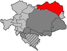
Donaumonarchie Galicië.png 519 × 393; 12 KB
-
Empire d'Autriche 1914 Galicie.png 3,507 × 2,480; 4.15 MB
-
Galicia administrative1914.jpg 598 × 450; 155 KB
-
Galicia and Lodomeria within Austria-Hungary 1914.png 3,507 × 2,480; 3.9 MB
-
Galicia Composite Voivodeship Administrative Map 1938.jpg 6,000 × 4,000; 8.36 MB
-
Galicia es.svg 275 × 264; 26 KB
-
Galicia Esri map.png 648 × 378; 959 KB
-
Galicia physical W.H.-de.png 598 × 450; 206 KB
-
Galicia physical1914-de.png 598 × 450; 169 KB
-
Galicja i Nowa Galicja - cyrkuły 1805 1830.png 696 × 661; 59 KB
-
Galicja i Nowa Galicja - cyrkuły 1805.png 696 × 661; 55 KB
-
Galicja.png 528 × 328; 21 KB
-
Galitzia (1914).svg 450 × 456; 509 KB
-
Galiz20.gif 275 × 264; 8 KB
-
Galizien Donaumonarchie.png 674 × 510; 7 KB
-
Galizien Israeliten 1910 ES.svg 1,075 × 700; 491 KB
-
Galizien Israeliten 1910-hu.svg 1,075 × 700; 106 KB
-
Galizien Israeliten 1910.svg 1,075 × 700; 91 KB
-
Halič, Židé 1910.svg 1,075 × 700; 191 KB
-
Kingdom of Galicia.png 613 × 600; 155 KB
-
Korolivstvo of galicia.png 742 × 726; 60 KB
-
Królestwo Galicji.png 490 × 480; 101 KB
-
Location Galicia in Europe.svg 2,045 × 1,720; 518 KB
-
Map Galicia central Europe.png 275 × 264; 4 KB
-
Map of the Kingdom of Galicia, 1914.jpg 598 × 450; 157 KB
-
Map-Galicia-Central Europe.svg 461 × 393; 516 KB
-
ReinoDeGalitzia.svg 991 × 718; 234 KB
-
Spór o Morskie Oko.PNG 830 × 649; 22 KB
-
Tales of Galicia 20th cent.jpg 598 × 450; 270 KB
-
Восточная и Западная Галиция.png 275 × 264; 4 KB


