Category:Maps of the Kingdom of Galicia (Central Europe)
Jump to navigation
Jump to search
Deutsch: Karten des Königreichs Galizien, heute Teil von Polen und der Ukraine
English: Maps of the Kingdom of Galicia in Central Europe, now part of Poland and Ukraine
Media in category "Maps of the Kingdom of Galicia (Central Europe)"
The following 78 files are in this category, out of 78 total.
-
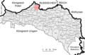
 Bezirk Biała.png 2,389 × 1,556; 604 KB
-
 Bezirk Bobrka.png 2,389 × 1,556; 603 KB
-
 Bezirk Bochnia.png 2,389 × 1,556; 604 KB
-
 Bezirk Bohorodczany.png 2,389 × 1,556; 607 KB
-
 Bezirk Borszczow.png 2,389 × 1,556; 603 KB
-
 Bezirk Brody.png 2,389 × 1,556; 604 KB
-
 Bezirk Brzesko.png 2,389 × 1,556; 604 KB
-
 Bezirk Brzezany.png 2,389 × 1,556; 604 KB
-
 Bezirk Brzozów.png 2,389 × 1,556; 604 KB
-
 Bezirk Chrzanów.png 2,389 × 1,556; 603 KB
-
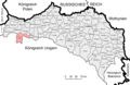
 Bezirk Cieszanow.png 2,389 × 1,556; 603 KB
-
 Bezirk Czortkow.png 2,389 × 1,556; 603 KB
-
 Bezirk Dobromil.png 2,389 × 1,556; 604 KB
-
 Bezirk Dolina.png 2,389 × 1,556; 607 KB
-
 Bezirk Drohobycz.png 2,389 × 1,556; 604 KB
-
 Bezirk Dąbrowa.png 2,389 × 1,556; 603 KB
-
 Bezirk Gorlice.png 2,389 × 1,556; 604 KB
-
 Bezirk Grodek.png 2,389 × 1,556; 604 KB
-
 Bezirk Grybow.png 2,389 × 1,556; 604 KB
-
 Bezirk Horodenka.png 2,389 × 1,556; 607 KB
-
 Bezirk Husiatyn.png 2,389 × 1,556; 603 KB
-
 Bezirk Jaroslau.png 2,389 × 1,556; 604 KB
-
 Bezirk Jasło.png 2,389 × 1,556; 604 KB
-
 Bezirk Jaworow.png 2,389 × 1,556; 604 KB
-
 Bezirk Kamionka Strumiłowa.png 2,389 × 1,556; 604 KB
-
 Bezirk Kamionka.png 2,389 × 1,556; 604 KB
-
 Bezirk Kałusz.png 2,389 × 1,556; 607 KB
-
 Bezirk Kolbuszowa.png 2,389 × 1,556; 603 KB
-
 Bezirk Kolomea.png 2,389 × 1,556; 603 KB
-
 Bezirk Kosów.png 2,389 × 1,556; 604 KB
-
 Bezirk Krakau.png 2,389 × 1,556; 603 KB
-
 Bezirk Krosno.png 2,389 × 1,556; 604 KB
-
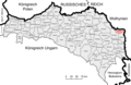
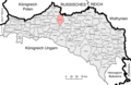
 Bezirk Lemberg.png 2,389 × 1,556; 606 KB
-
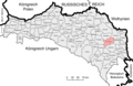
 Bezirk Limanowa.png 2,389 × 1,556; 604 KB
-
 Bezirk Lisko.png 2,389 × 1,556; 604 KB
-
 Bezirk Mielec.png 2,389 × 1,556; 603 KB
-
 Bezirk Mosciska.png 2,389 × 1,556; 603 KB
-
 Bezirk Myslenice.png 2,389 × 1,556; 617 KB
-
 Bezirk Nadwórna.png 2,389 × 1,556; 604 KB
-
 Bezirk Nisko.png 2,389 × 1,556; 603 KB
-
 Bezirk NowySacz.png 2,389 × 1,556; 604 KB
-
 Bezirk NowyTarg.png 2,389 × 1,556; 604 KB
-
 Bezirk Pilzno.png 2,389 × 1,556; 603 KB
-
 Bezirk Podhajce.png 2,389 × 1,556; 604 KB
-
 Bezirk Przemysl.png 2,389 × 1,556; 603 KB
-
 Bezirk Przemyslany.png 2,389 × 1,556; 604 KB
-
 Bezirk RawaRuska.png 2,389 × 1,556; 604 KB
-
 Bezirk Rohatyn.png 2,389 × 1,556; 603 KB
-
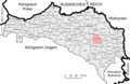
 Bezirk Ropczyce.png 2,389 × 1,556; 603 KB
-
 Bezirk Rudki.png 2,389 × 1,556; 604 KB
-
 Bezirk Rzeszów.png 2,389 × 1,556; 604 KB
-
 Bezirk Sambor.png 2,389 × 1,556; 604 KB
-
 Bezirk Sanok.png 2,389 × 1,556; 604 KB
-
 Bezirk Saybusch.png 2,389 × 1,556; 604 KB
-
 Bezirk Skalat.png 2,389 × 1,556; 604 KB
-
 Bezirk Sniatyn.png 2,389 × 1,556; 603 KB
-
 Bezirk Sokal.png 2,389 × 1,556; 603 KB
-
 Bezirk Stanislau.png 2,389 × 1,556; 603 KB
-
 Bezirk StarySambor.png 2,389 × 1,556; 604 KB
-
 Bezirk Stryj.png 2,389 × 1,556; 604 KB
-
 Bezirk Tarnobrzeg.png 2,389 × 1,556; 603 KB
-
 Bezirk Tarnopol.png 2,389 × 1,556; 604 KB
-
 Bezirk Tarnów.png 2,389 × 1,556; 604 KB
-
 Bezirk Trembowla.png 2,389 × 1,556; 603 KB
-
 Bezirk Turka.png 2,389 × 1,556; 604 KB
-
 Bezirk Tłumacz.png 2,389 × 1,556; 603 KB
-
 Bezirk Wadowice.png 2,389 × 1,556; 617 KB
-
 Bezirk Wieliczka.png 2,389 × 1,556; 604 KB
-
 Bezirk Zaleszczyki.png 2,389 × 1,556; 603 KB
-
 Bezirk Zbaraz.png 2,389 × 1,556; 604 KB
-
 Bezirk Zydaczow.png 2,389 × 1,556; 604 KB
-
 Bezirk Złoczów.png 2,389 × 1,556; 604 KB
-
 Bezirk Łańcut.png 2,389 × 1,556; 604 KB
-
 Bezirk Żółkiew.png 2,389 × 1,556; 603 KB
-
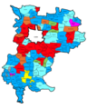
 BezirkLemberg1900Sprachen.png 2,607 × 2,793; 873 KB
-
 Polska w poczatku 12. wiek.jpg 2,178 × 1,672; 833 KB
-
 Powiatlwowski1921.png 2,607 × 3,267; 800 KB
-
 Powiatlwowski1939.png 2,607 × 3,267; 814 KB


