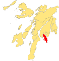
Category:Maps of the Isle of Bute
Jump to navigation
Jump to search
Subcategories
This category has only the following subcategory.
O
- Old maps of the Isle of Bute (17 F)
Media in category "Maps of the Isle of Bute"
The following 4 files are in this category, out of 4 total.
-
Admiralty Chart No 1907 Cloch Point to Little Cumbrae Island, Published 1969.jpg 11,200 × 18,788; 22.07 MB
-
Admiralty Chart No 2131 Firth of Clyde & Loch Fyne, Published 1956.jpg 6,836 × 9,816; 30.32 MB
-
Bute Inner Hebrides.svg 1,161 × 2,563; 4.35 MB
-
Isle of Bute.svg 1,254 × 1,281; 362 KB


