Category:Maps of the Isle of Arran
Jump to navigation
Jump to search
Subcategories
This category has only the following subcategory.
- Old maps of the Isle of Arran (25 F)
Media in category "Maps of the Isle of Arran"
The following 18 files are in this category, out of 18 total.
-
 Admiralty Chart No 1825a The Irish Sea, Published 1925.jpg 16,412 × 15,521; 22.26 MB
-
 Admiralty Chart No 1864 Plans in the Firth of Clyde, Published 1958.jpg 8,270 × 12,088; 27.3 MB
-
 Admiralty Chart No 2164 Fith of Clyde Bennane Head to Largs Channel, Published 1969.jpg 11,302 × 16,359; 23.06 MB
-
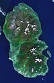 Arran satellite.jpg 752 × 1,138; 144 KB
-
 Arran.PNG 199 × 218; 4 KB
-
 Buteshire map.png 466 × 618; 386 KB
-
 Institute of Geological Sciences Geological Map of Arran Solid, Published 1972.jpg 11,764 × 13,888; 41.17 MB
-
 Isle of Arran locator.png 640 × 608; 668 KB
-
 Isle of Arran OS OpenData map.png 1,008 × 1,414; 288 KB
-
 Isle of Arran- fr.png 386 × 567; 147 KB
-
 Isle of Arran.png 253 × 372; 34 KB
-
 Arran Inner Hebrides.svg 1,161 × 2,563; 4.35 MB
-
 NHSayrshirearran.png 2,733 × 3,411; 215 KB
-
 Ordnance Survey One-Inch Sheet 76 Kintyre, Published 1925.jpg 10,558 × 15,392; 14.21 MB
-
 Ordnance Survey Quarter-inch sheet 2 Scotland south-west, published 1946.jpg 15,110 × 10,911; 17.48 MB
-
 Ordnance Survey Quarter-inch sheet 6 Firth of Clyde, published 1965.jpg 9,628 × 8,893; 10.55 MB
-
 Ordnance Survey Quarter-inch sheet 6 Firth of Clyde, published 1973.jpg 12,916 × 11,785; 63.56 MB
-
 UK Arran.PNG 648 × 584; 19 KB


