Category:Maps of the Insular Celts
Jump to navigation
Jump to search
Media in category "Maps of the Insular Celts"
The following 27 files are in this category, out of 27 total.
-
 Atrébates (territoire).png 496 × 362; 27 KB
-
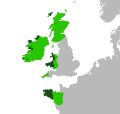
 Celtic nations + Galicia and Asturias in Europe (bordered).svg 680 × 520; 725 KB
-
 Celtic nations + Galicia and Asturias in Europe (borderless).svg 680 × 520; 362 KB
-
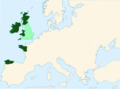
 Celtic nations in Europe (bordered).svg 680 × 520; 729 KB
-
 Celtic nations in Europe (borderless).svg 680 × 520; 359 KB
-
 Celtic-nations-and-language.svg 400 × 380; 146 KB
-
 CelticNationsMap.jpg 464 × 678; 58 KB
-
 Celts in Europe-fr.png 933 × 695; 121 KB
-
 CymruLlwythi.PNG 514 × 566; 10 KB
-
 England Celtic tribes - South-he.png 550 × 297; 77 KB
-
 England Celtic tribes - South.png 550 × 297; 96 KB
-
 Fictional Celtic State.svg 215 × 380; 87 KB
-
 Keltisch Sprachen eo.svg 352 × 519; 164 KB
-
 Keltisch Sprachen.svg 352 × 519; 164 KB
-
 Kornisch.png 380 × 304; 30 KB
-
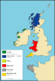
 Locatie Keltische Zee.PNG 649 × 475; 21 KB
-
 Map of Celtic Nations (alternate).svg 675 × 1,300; 90 KB
-
 Map of Celtic Nations-flag shades.svg 675 × 1,300; 173 KB
-
 Map of Celtic Nations.svg 675 × 1,300; 97 KB
-
 Map of the Territory of the Corieltauvi.svg 744 × 1,052; 148 KB
-
 Map of the Territory of the Cornovii (Midlands).png 737 × 873; 126 KB
-
 Map of the Territory of the Cornovii (Midlands).svg 700 × 900; 117 KB
-
 Map of the Territory of the Dobunni.svg 744 × 1,052; 148 KB
-
 Mappa an Mor Keltek.png 431 × 719; 24 KB
-
 North Britain 547-685.png 794 × 683; 818 KB
-
 Yezhoù keltiek.svg 352 × 519; 110 KB
-
 Yr.Hen.Ogledd.550.650.Koch.jpg 1,500 × 1,794; 510 KB
.png)
.svg)
.svg)
.svg)
.svg)


.svg)


.png)
.svg)


