Category:Maps of the Celts
Jump to navigation
Jump to search
Subcategories
This category has the following 7 subcategories, out of 7 total.
A
G
M
- Maps of Celtic people (27 F)
- Maps of Cisalpine Gaul (14 F)
- Maps of Iron Age Britain (32 F)
- Maps of the Iberian Celts (33 F)
- Maps of the Insular Celts (27 F)
Media in category "Maps of the Celts"
The following 122 files are in this category, out of 122 total.
-
 3-bc map elznik.jpg 695 × 545; 203 KB
-

-

-
 ArcheologicalCulturesOfCentralEuropeAtEarlyPreRomanIronAge-es.svg 519 × 494; 630 KB
-
 ArcheologicalCulturesOfCentralEuropeAtEarlyPreRomanIronAge.png 545 × 515; 12 KB
-
 AtlBalk.a-660.jpg 318 × 327; 25 KB
-
 AtlBalk.b-530.jpg 318 × 327; 29 KB
-
 AtlBalk.c-430.jpg 318 × 327; 164 KB
-
 AtlBalk.d-330.jpg 318 × 327; 161 KB
-
 AtlBalk.e-150.jpg 318 × 327; 168 KB
-
 AtlBalk0.jpg 318 × 327; 156 KB
-
 Bataille Bibracte -58.png 3,702 × 1,197; 571 KB
-
 Bataille Genève -58.png 1,209 × 1,018; 277 KB
-
 Battaglia Bibracte Elvezi tre fasi png.png 3,702 × 1,197; 569 KB
-
 Battaglia di Alesia fortificazioni.png 2,684 × 1,884; 284 KB
-
 Battaglia Gergovia 52 aC fase 2.png 1,726 × 1,053; 92 KB
-
 Battaglia Gergovia 52 aC.png 1,726 × 1,053; 84 KB
-
 Boians.png 1,804 × 858; 1.8 MB
-
 Celtic peoples in Antiquity.png 1,231 × 929; 81 KB
-
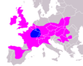 Distribution of Celts in Europe.png 360 × 287; 9 KB
-
 Erecura distribution.png 658 × 404; 12 KB
-
 Gaelic genepool in Eastern Europe.png 333 × 542; 81 KB
-
 Gaelic genepool in western europe.png 321 × 454; 89 KB
-
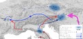
 Gaul Migration Map (English)-gl.svg 2,228 × 726; 1.72 MB
-
 Gaul Migration Map (English).svg 2,089 × 681; 1.72 MB
-
 Gaul Migration Map (Portuguese).svg 2,089 × 681; 1.72 MB
-
 Siège GergovieI -52.png 1,726 × 1,053; 88 KB
-
 Gorgobina.jpg 1,033 × 1,423; 379 KB
-
 Hallstatt culture-de.svg 1,269 × 1,065; 347 KB
-
 Hallstatt culture.png 538 × 320; 253 KB
-
 Hallstatt LaTene.png 600 × 438; 250 KB
-
 Hallstatt.png 1,342 × 1,054; 382 KB
-
 Histoire de la ville de Châlons-sur-Marne 44647.jpg 3,949 × 2,591; 8.96 MB
-
 Iberia 211-210BC-it (cropped).png 439 × 321; 73 KB
-
 Illyrian Tribes (Deutsch).svg 1,600 × 1,600; 8.57 MB
-
 Illyrian Tribes (English).svg 1,600 × 1,600; 8.57 MB
-
 Illyrian Tribes (Español).svg 1,600 × 1,600; 8.57 MB
-
 Illyrian Tribes (Français).svg 1,600 × 1,600; 8.57 MB
-
 Illyrian Tribes (Italiano).svg 1,600 × 1,600; 8.57 MB
-
 Illyrian Tribes (Portuguese).svg 1,600 × 1,600; 8.57 MB
-
 Illyrian Tribes (Pусский).svg 1,600 × 1,600; 8.57 MB
-
 Illyrian Tribes (Shqipe).svg 1,600 × 1,600; 8.57 MB
-
 Illyrian Tribes (Български).svg 1,600 × 1,600; 8.57 MB
-
 Illyrian Tribes (Македонски).svg 1,600 × 1,600; 8.57 MB
-
 Illyrian Tribes (Српски-srpski).svg 1,600 × 1,600; 8.57 MB
-
 Illyrian Tribes es.svg 2,873 × 2,493; 15.64 MB
-
 Illyrian Tribes satellite Map (English).svg 947 × 791; 2.36 MB
-
 Illyrian Tribes satellite Map (Greek).svg 947 × 791; 2.36 MB
-
 Illyrian Tribes Visually impaired version (English).svg 652 × 432; 136 KB
-
 Illyrian Tribes Visually impaired version (Portuguese).svg 652 × 432; 137 KB
-
 Illyrians (Deutsch).svg 1,600 × 1,600; 5.11 MB
-
 Illyrians (English).svg 1,600 × 1,600; 5.11 MB
-
 Illyrians (Español).svg 1,600 × 1,600; 5.11 MB
-
 Illyrians (Français).svg 1,600 × 1,600; 5.11 MB
-
 Illyrians (Hungarian).svg 1,600 × 1,600; 5.11 MB
-
 Illyrians (Italiano).svg 1,600 × 1,600; 5.11 MB
-
 Illyrians (Portuguese).svg 1,600 × 1,600; 5.11 MB
-
 Illyrians (Pусский).svg 1,600 × 1,600; 5.11 MB
-
 Illyrians (Shqipe).svg 1,600 × 1,600; 5.11 MB
-
 Illyrians (Български).svg 1,600 × 1,600; 5.11 MB
-
 Illyrians (Македонски).svg 1,600 × 1,600; 5.11 MB
-
 Illyrians (Српски-srpski).svg 1,600 × 1,600; 5.11 MB
-
 Illyrians.jpg 1,054 × 714; 1.27 MB
-
 IllyrianTribes.jpg 2,000 × 2,000; 2.24 MB
-
 IllyricumAD6RomanConditionofTribes.png 1,836 × 1,533; 2.56 MB
-
 Indo Europeans Vojvodina map-sr.png 983 × 923; 78 KB
-
 Indo Europeans Vojvodina map.png 983 × 923; 84 KB
-
 Italy IV century BC - Latina.svg 1,033 × 1,298; 1.31 MB
-
 Italy IV century BC - Portuguese.svg 1,033 × 1,298; 1.33 MB
-
 Kelten Austria.png 2,324 × 1,495; 418 KB
-
 Keltové 800-400BC.png 450 × 319; 61 KB
-
 La Tène Culture.jpg 899 × 669; 79 KB
-
 Localisation Volques.jpg 400 × 300; 23 KB
-
 Lugubus inscriptions distribution.svg 1,500 × 1,274; 37 KB
-
 Map of ancient Epirus and environs (Deutsch).svg 1,422 × 1,614; 1.76 MB
-
 Map of ancient Epirus and environs (English) alternate contrast.svg 1,278 × 1,470; 6.06 MB
-
 Map of ancient Epirus and environs (English).svg 1,303 × 1,500; 495 KB
-
 Map of ancient Epirus and environs (Español).svg 1,303 × 1,500; 5.44 MB
-
 Map of ancient Epirus and environs (Français).svg 1,303 × 1,500; 381 KB
-
 Map of ancient Epirus and environs (Italiano).svg 1,303 × 1,500; 383 KB
-
 Map of ancient Epirus and environs (Português).svg 1,303 × 1,500; 379 KB
-
 Map of ancient Epirus and environs (Pусский).svg 1,303 × 1,500; 378 KB
-
 Map of ancient Epirus and environs (Shqipe).svg 1,303 × 1,500; 380 KB
-
 Map of ancient Epirus and environs (Български).svg 1,303 × 1,500; 378 KB
-
 Map of ancient Epirus and environs (Македонски).svg 1,303 × 1,500; 378 KB
-
 Map of ancient Epirus and environs (Српски-srpski).svg 1,303 × 1,500; 379 KB
-
 Map of Europe according to Strabo.jpg 485 × 385; 152 KB
-
 Mapa de Portugal tribos principais.png 335 × 728; 49 KB
-
 Odrysian Kingdom Map.jpg 701 × 499; 68 KB
-
 Oppidum gaulois de Castrum Caninum (Château-Chinon).svg 972 × 1,211; 1.29 MB
-
 Plan Bibracte-es.svg 606 × 650; 62 KB
-
 Plan Bibracte-fr.svg 606 × 650; 89 KB
-
 Plan Bibracte-it.svg 606 × 650; 62 KB
-
 Popolazioni preromane del Piemonte.jpg 700 × 960; 212 KB
-
 Rosmerta Cantismerta distribution.png 410 × 375; 7 KB
-
 Scordisci state-sr.png 813 × 565; 37 KB
-
 Scordisci state.png 813 × 565; 38 KB
-
 Siège Alésia -52.png 2,684 × 1,884; 284 KB
-
 Siège GergovieII -52.png 1,726 × 1,053; 96 KB
-
 South Illyria & Environs (English).svg 672 × 654; 694 KB
-
 South Illyria & Environs (Portuguese).svg 672 × 654; 694 KB
-
 South Illyria and Environs (English).png 782 × 1,030; 196 KB
-
 Spedizioni celtiche in Grecia nei Balcani e in Anatolia (III secolo a.C.)-es.svg 1,963 × 1,104; 124 KB
-
 Spedizioni celtiche in Grecia nei Balcani e in Anatolia (III secolo a.C.)-pt.svg 1,963 × 1,104; 124 KB
-
 Spedizioni celtiche in Grecia nei Balcani e in Anatolia (III secolo a.C.).svg 1,963 × 1,104; 117 KB
-
 Staemme im antiken Thrakien.svg 1,067 × 717; 19.71 MB
-
 Tribes in Ancient Thrace (English).png 3,000 × 3,000; 7.85 MB
-
 Tribes in Ancient Thrace (English).svg 3,000 × 3,000; 8.66 MB
-
 Tribes in Ancient Thrace (Portuguese).svg 3,000 × 3,000; 8.66 MB
-
 Tribes in Illyria (English).svg 1,600 × 1,600; 5.17 MB
-
 Tribes in Illyria (Greek).svg 1,600 × 1,600; 5.18 MB
-
 Tribes in Illyria (Portuguese).svg 1,600 × 1,600; 5.17 MB
-
 Tribes in Illyria (Pусский).svg 1,600 × 1,600; 5.18 MB
-
 Villabé - Carte gaulois.svg 1,423 × 1,209; 61 KB
-
 Visucius distribution.png 500 × 392; 12 KB
-
 Volcae Arecomisci and Tectosages (migrations)-pt.svg 2,052 × 955; 333 KB
-
 Volcae Arecomisci and Tectosages (migrations).svg 2,052 × 955; 333 KB
-
 Volcae Tectosages.jpg 786 × 786; 204 KB
-
 Volcae-eo.svg 2,052 × 955; 334 KB
-
 Volcae-fr.svg 2,052 × 955; 333 KB
-
 Volci Arecomici e Tectosagi (migrazioni).svg 2,052 × 955; 333 KB
-
 Épône - Carte gaulois.svg 1,423 × 1,209; 75 KB

.jpg)


.png)
.svg)
.svg)
.svg)
.svg)
.svg)
.svg)
.svg)
.svg)
.svg)
.svg)
.svg)

.svg)
.svg)
.svg)
.svg)
.svg)
.svg)
.svg)
.svg)
.svg)
.svg)
.svg)
.svg)
.svg)
.svg)
.svg)
.svg)


.svg)
_alternate_contrast.svg)
.svg)
.svg)
.svg)
.svg)
.svg)
.svg)
.svg)
.svg)
.svg)
.svg)


.svg)


.svg)
.svg)
.png)
-es.svg)
-pt.svg)
.svg)

.png)
.svg)
.svg)
.svg)
.svg)
.svg)
.svg)


-pt.svg)
.svg)


.svg)

-gl.svg)
.svg)
.svg)