Category:Maps of the Indo-European expansion
Jump to navigation
Jump to search
Media in category "Maps of the Indo-European expansion"
The following 27 files are in this category, out of 27 total.
-
 Early Indo-European river names.jpg 1,677 × 1,167; 777 KB
-
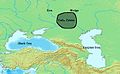 Early Yamna.jpg 624 × 385; 84 KB
-
 Eastern and Central Europe around 750 BC.png 693 × 505; 272 KB
-
 From Corded Ware to Sintashta.jpg 800 × 437; 241 KB
-
 Indo-european - kurgan - 4000 BC - map.jpg 740 × 404; 92 KB
-
 Indo-european - languages - evolution - 500 BC - map.jpg 750 × 410; 97 KB
-

-
 Indo-European expansions.jpg 2,094 × 1,024; 1.99 MB
-
 Indo-european language - yamna-culture - 3000 BC - map.jpg 740 × 404; 92 KB
-
 Indo-european languages - expansion 2000 BC - map.jpg 740 × 404; 99 KB
-
 Indo-European migrations and Ancient Northeast Asians.png 6,652 × 2,744; 32.85 MB
-
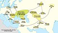 Indo-European Migrations. Source David Anthony (2007), The Horse, The Wheel and Language.jpg 2,906 × 1,642; 1.34 MB
-
 Indo-European migrations.gif 1,200 × 598; 2.28 MB
-
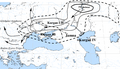
 Indo-European migrations.jpg 3,326 × 1,372; 6.09 MB
-
 Indogermanen-Mythos Karte 1907.jpg 1,064 × 659; 1.26 MB
-
 Kurgan map.png 650 × 374; 154 KB
-
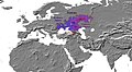
 Origins and migration of R1a1.jpg 1,608 × 980; 1.04 MB
-

-
-
 R1a1a frequency and distribution (Underhill 2010).jpg 1,548 × 964; 809 KB
-
 Underhill 2010.jpg 1,228 × 784; 741 KB
-
 Yamnaya Steppe Pastoralists.jpg 3,326 × 1,372; 6.03 MB
-
 Yamnaya-related migrations.jpg 3,326 × 1,372; 5.94 MB
-
 Миграция индоевропейцев.jpg 1,189 × 673; 459 KB
-
 Прародина-индоевропейцев.png 1,000 × 676; 405 KB
-
 Схема, Зализняк.jpg 920 × 652; 393 KB
-
 ヤムナヤ関連移住.jpg 1,798 × 742; 400 KB


.png)


,_The_Horse,_The_Wheel_and_Language.jpg)


_and_R1a1a_oldest_expansion_and_highest_frequency_(2014).jpg)
,_Iranian_farmers_(Lazaridis_2016),_Yamna_people_(Jones_2015),_Corded_Ware_(Haak_2015),_Andronovo_(Allentoft_2015),_lactose_(Gallego_Romero_2011)_v04.jpg)
.jpg)


