Category:Maps of the Himalayas
Appearance
Subcategories
This category has the following 6 subcategories, out of 6 total.
E
- Maps of Mount Everest (42 F)
G
M
- Maps of Kangchenjunga (25 F)
- Maps of Makalu (12 F)
- Maps of the Yarlung Tsangpo (37 F)
O
- Old maps of the Himalayas (10 F)
Media in category "Maps of the Himalayas"
The following 120 files are in this category, out of 120 total.
-
Indomalaya.png 1,096 × 744; 48 KB
-
14 Ochomiles.png 4,480 × 2,472; 10.45 MB
-
Der Jesuiten-Atlas der Kanghsi-Zeit - China und die Aussenlaender LOC 74650033-14.jpg 9,910 × 9,318; 8.99 MB
-
Der Jesuiten-Atlas der Kanghsi-Zeit - China und die Aussenlaender LOC 74650033-14.tif 9,910 × 9,318; 264.19 MB
-
1912 China map from National Geographic.jpg 6,980 × 5,326; 10.65 MB
-
1914 Survey of India map of Tibet and Adjacent Countries.jpg 15,788 × 10,680; 9.8 MB
-
A land cover map of the HKH region was developed using Landsat 30-meter data..png 1,859 × 1,050; 3.29 MB
-
Abhandlungen der Königlichen Akademie der Wissenschaften in Berlin (1830) (16578426588).jpg 3,260 × 2,526; 1.83 MB
-
Achttausender Neu.png 1,598 × 750; 2.47 MB
-
Achttausender.png 1,598 × 750; 2.51 MB
-
Annapurna region based on 1951 Herzog map.svg 896 × 615; 227 KB
-
Annapurna, India Survey + Herzog.svg 733 × 346; 155 KB
-
Asia Wikivoyage locator maps - Himalayas.png 287 × 237; 7 KB
-
Baghmati catchment.jpg 1,124 × 788; 223 KB
-
Carte de l'Himalaya Central et du Thibet Méridional (33746335224).jpg 7,419 × 4,794; 20.26 MB
-
DEMTibet annotated.png 3,145 × 1,763; 6.77 MB
-
DEMTibet.png 3,145 × 1,763; 8.73 MB
-
Dhaulagiri, India Survey + Herzog.svg 733 × 346; 101 KB
-
Dhauliganga and Rishiganga Valleys.jpg 1,925 × 2,809; 2.76 MB
-
Digital elevation model (DEM) of Mt. Everest region - 50090950171.png 620 × 852; 1.13 MB
-
Digital elevation model (DEM) of the Mt. Everest region - 50090548573.png 2,006 × 1,575; 4.93 MB
-
Digital elevation model of small Himalayan glaciers - 50090950206.jpg 620 × 592; 434 KB
-
Eight Thousanders Map.png 1,121 × 794; 161 KB
-
Etats-Himalaya.jpg 965 × 473; 320 KB
-
EurasianPlate.png 1,740 × 1,130; 493 KB
-
Everest Deodanga 1858.jpg 1,668 × 1,175; 740 KB
-
Gandak catchment.jpg 1,128 × 1,126; 368 KB
-
Ganga catchment.jpg 1,257 × 1,222; 391 KB
-
GobiTaklamakanMap.jpg 1,968 × 1,567; 656 KB
-
High Asia Mountain Ranges.jpg 5,600 × 4,400; 10.79 MB
-
Himalaya location map.png 2,216 × 1,146; 622 KB
-
Himalaya Map.jpg 2,100 × 1,800; 959 KB
-
Himalaya political map EN.svg 1,481 × 1,000; 951 KB
-
Himalaya political map NL.svg 1,481 × 1,000; 947 KB
-
Himalayan ranges map.jpg 1,828 × 1,393; 1.33 MB
-
Himalayan river catchments.jpg 2,004 × 1,381; 999 KB
-
Himalayas 1849.jpg 3,468 × 1,792; 1.71 MB
-
Himalayas Map Slovenian.png 761 × 539; 741 KB
-
Himalayas Map.png 761 × 539; 356 KB
-
Indian subcontinent drift-fr.svg 234 × 424; 37 KB
-
Indian subcontinent drift-lb.svg 234 × 424; 36 KB
-
Indian subcontinent drift-pl.svg 234 × 424; 37 KB
-
Jamuna catchment.jpg 1,401 × 672; 180 KB
-
Kali drainage.jpg 1,316 × 1,967; 283 KB
-
Kamarupa-inscriptions-findspots.png 1,011 × 696; 398 KB
-
Karakoram map.jpg 2,099 × 2,288; 4.42 MB
-
Karnali catchment.jpg 1,440 × 1,198; 536 KB
-
Khalil Jami 2.jpg 1,500 × 1,102; 713 KB
-
Kosi catchment.jpg 1,418 × 1,112; 473 KB
-
Kumaun terrain.jpg 1,532 × 1,224; 1.94 MB
-
Manas catchment.jpg 1,204 × 860; 268 KB
-
Map India and Pakistan 1-250,000 Tile NG 45-4 Phari Dzong.jpg 5,000 × 3,815; 6.06 MB
-
Map India and Pakistan 1-250,000 Tile NH 44-6 Nanda Devi.jpg 5,000 × 3,799; 4.02 MB
-
Map India and Pakistan 1-250,000 Tile NH 45-13 Jongkha Dzong.jpg 5,000 × 3,774; 4.21 MB
-
Map of High Mountain Asia - 50091108786.png 1,535 × 958; 1.59 MB
-
Map of Kharta region, east of Mount Everest.svg 1,279 × 1,194; 464 KB
-
Map of Ladakh or Little Tibet (Klein Tubet) in 1858 Vorder-Asien (cropped).jpg 777 × 1,143; 473 KB
-
Map of Tibet in 1831 from Ost-Indien Mit Den Inseln (cropped).jpg 1,898 × 981; 851 KB
-
Map, Uttari Nanda Devi Glacier.jpg 374 × 486; 132 KB
-
Mount Everest - Hillary and Norgay route - map-fr.svg 1,000 × 735; 1.03 MB
-
Mount Everest Climbing Routes 1924-1996 photomap-fr.svg 1,208 × 900; 1.11 MB
-
Mount Everest location in Himalaya map-Ar.png 2,000 × 1,151; 3.91 MB
-
Mount Everest location in Himalaya map-fr.svg 1,190 × 685; 1.33 MB
-
Mount Everest location in Himalaya map-hu.svg 1,190 × 685; 1.31 MB
-
Mount Everest location in Himalaya map-mk.svg 1,190 × 685; 1.35 MB
-
Mount Everest location in Himalaya map-ru.svg 1,190 × 685; 1.31 MB
-
Mount Everest location in Himalaya map-uk.svg 1,190 × 685; 1.3 MB
-
Mount Everest region map-fr.svg 1,733 × 1,334; 1.04 MB
-
Mount Everest tourists flow map 1980-2000 -fr.svg 1,250 × 1,750; 2.47 MB
-
Nanda Devi Sanctuary sketch map.svg 4,270 × 3,318; 265 KB
-
Nanda Devi Sanctuary.svg 4,270 × 3,318; 266 KB
-
Nanga Parbat 1953 map 01.png 805 × 986; 187 KB
-
Nanga Parbat 1953 map detail.png 698 × 491; 111 KB
-
Nanga Parbat 1953 map.svg 756 × 924; 108 KB
-
Nepal location map - Himalayas region.png 1,200 × 714; 174 KB
-
Pamir administrative map-fr.svg 3,543 × 2,271; 4.47 MB
-
Pamir biomes map-fr.svg 3,543 × 2,271; 4.5 MB
-
Pamir drainage basin map-fr.svg 3,543 × 2,271; 4.59 MB
-
Pamir ethnological map-fr.svg 3,543 × 2,271; 3.31 MB
-
Pamir protected area map-fr.svg 3,543 × 2,271; 4.56 MB
-
Pamir topographic map-fr.svg 3,543 × 2,271; 4.41 MB
-
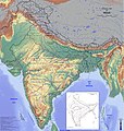
Physical Map of India.jpg 4,724 × 4,960; 7.68 MB
-
Pope1880NorthWesternProv2.jpg 1,200 × 888; 218 KB
-
Raidak catchment.jpg 1,184 × 1,104; 471 KB
-
Rapti catchment.jpg 1,440 × 770; 122 KB
-
Razze himalaiane (cani) - mappa.png 761 × 539; 664 KB
-
Rongbuk Glacier animation.gif 990 × 610; 1.68 MB
-
Shipton-Tilman 1934 Garhwal routes.svg 1,169 × 991; 225 KB
-
Sivallik Hills map.svg 3,099 × 2,868; 6.99 MB
-
Sketch Map of the glaciers of Kangchenjunga by Edmund J. Garwood, 1903 (cropped).jpg 2,125 × 2,038; 1,008 KB
-
Tarim bassin.png 1,200 × 750; 1.34 MB
-
The High Asia fluvial network.png 1,200 × 965; 1.85 MB
-
Tilted, 1914 Survey of India map of Tibet and Adjacent Countries (cropped).jpg 4,860 × 3,915; 1.2 MB
-
Tista catchment.jpg 992 × 832; 236 KB
-
ZabuyeLake1.png 584 × 456; 546 KB
-
Zentralasien topo.png 1,600 × 1,038; 2.47 MB


