Category:Maps of mountain ranges of Asia
Jump to navigation
Jump to search
Maps of mountain ranges of Asia.
Subcategories
This category has the following 11 subcategories, out of 11 total.
A
- Maps of the Altay Mountains (13 F)
H
- Maps of the Hindu Kush (21 F)
I
K
- Maps of Koh-e Baba (4 F)
U
Z
- Maps of the Zagros Mountains (17 F)
Media in category "Maps of mountain ranges of Asia"
The following 39 files are in this category, out of 39 total.
-

-
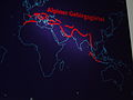 Alpiner Gebirgsgürtel, NÖ Landesmuseum.jpg 2,272 × 1,704; 907 KB
-
 Alpiner Gebirgsgürtel.png 948 × 751; 1.22 MB
-
 Asia.PNG 696 × 427; 225 KB
-
 Chaîne Annamitique.png 662 × 562; 516 KB
-
 Highestmtns.png 1,213 × 733; 1.88 MB
-
 Hindu-Kush-Range.png 1,115 × 696; 1.47 MB
-
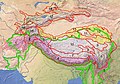 Hochasien Gliederung.jpg 2,235 × 1,566; 3.98 MB
-
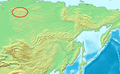
 Location Altay Mountains.PNG 696 × 427; 224 KB
-
 Location Baikal Mountains.PNG 696 × 427; 225 KB
-
 Location Chersky Range.PNG 696 × 427; 225 KB
-
 Location Dzhugdzhur Mountains.PNG 696 × 427; 225 KB
-
 Location Putoran Mountains.PNG 696 × 427; 225 KB
-
 Location Sayan Mountains.PNG 696 × 427; 225 KB
-
 Location Stanovoy Range.PNG 696 × 427; 224 KB
-
 Location Verkhoyansk Range.PNG 696 × 427; 225 KB
-
 Location Yablonoi Mountains.PNG 696 × 427; 224 KB
-
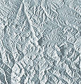 Mount Everest Vorlage SRTM3-1.jpg 3,792 × 3,960; 9.09 MB
-
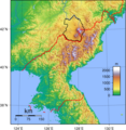 North Korea Topography Changbai.png 1,705 × 1,753; 4.26 MB
-
 North Korea Topography Chogyuryong.png 1,705 × 1,753; 4.26 MB
-
 North Korea Topography Hamgyong.png 1,705 × 1,753; 4.26 MB
-
 North Korea Topography Kangnam.png 1,705 × 1,753; 4.26 MB
-
 North Korea Topography Machol.png 1,705 × 1,753; 4.26 MB
-
 North Korea Topography Myohyang.png 1,705 × 1,753; 4.26 MB
-
 North Korea Topography Pujonryong.png 1,705 × 1,753; 4.26 MB
-
 North Korea Topography Puksu.png 1,705 × 1,753; 4.26 MB
-
 North Korea Topography Rangnim.png 1,705 × 1,753; 4.26 MB
-
 North Korea Topography Yonhwa.png 1,705 × 1,753; 4.26 MB
-
 Pontisches Gebirge.png 900 × 431; 608 KB
-
 Puncak Jaya topographic map-fr.svg 1,280 × 915; 1.22 MB
-
 Puncak Jaya topographic map-hu.svg 1,280 × 915; 868 KB
-
 Puncak Jaya topographic map-id.svg 1,280 × 915; 1.17 MB
-
 Puncak Jaya topographic map-mk.svg 1,280 × 915; 1.49 MB
-
 Sivallik Hills map.svg 3,099 × 2,868; 6.99 MB
-
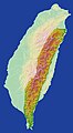 Taiwan-Central Mountain Range.jpg 1,974 × 3,600; 1.62 MB
-
 Pamir administrative map-fr.svg 3,543 × 2,271; 4.47 MB
-
 Pamir protected area map-fr.svg 3,543 × 2,271; 4.56 MB
-
 Pamir topographic map-fr.svg 3,543 × 2,271; 4.41 MB
-
 Рельеф Тянь-Шаня.png 1,433 × 325; 731 KB
%27_(11245131224).jpg)


