Category:Maps of the Franciscan Cadaster of Bohemia
Jump to navigation
Jump to search
Čeština: Katastrální mapy Čech v měřítku 1:2880 pořizované v rámci Stabilního katastru (Franziszeische Kataster) ve 20. až 40. letech 19. století na základě patentu císaře Františka I. z 23. prosince 1817.
Media in category "Maps of the Franciscan Cadaster of Bohemia"
The following 111 files are in this category, out of 111 total.
-
 Augezder Thor.png 1,591 × 1,239; 3.18 MB
-
 Beneschau COSK 1840 detail.jpg 3,000 × 2,000; 3 MB
-
 Beneschau COSK 1840.jpg 3,000 × 2,000; 2.92 MB
-
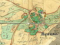 Brazna1839.jpg 2,383 × 1,768; 3.45 MB
-
 Broumov centrum SK 1840.jpg 2,186 × 2,784; 2.57 MB
-
 Broumov SK 1840.jpg 1,746 × 4,000; 1.97 MB
-
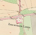 Bílý Beránek - stabilní katastr 2.jpg 380 × 369; 34 KB
-
 Bílý Beránek - stabilní katastr.jpg 744 × 485; 66 KB
-
 Běhánky mapa19 stol.JPG 571 × 530; 40 KB
-
 ChadimuvMlynBrazna1839.jpg 2,310 × 1,432; 2.43 MB
-
 Chotebor COSK 1838.jpg 2,815 × 4,000; 3.69 MB
-
 Chotebor RSK 1885.jpg 2,159 × 4,000; 3.5 MB
-
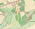
 Dolní Prosíčka 1838.jpg 910 × 503; 92 KB
-
 Dusniky SK 1840.jpg 2,098 × 1,346; 1.01 MB
-
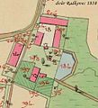 Dvůr Radkovec stabil 1838.jpg 506 × 559; 67 KB
-
 Franzkat 0867-2-003 (Schwarzenbach).jpg 8,149 × 6,769; 4.99 MB
-
 Franzkat Croquis Schwarzenbach.jpg 2,025 × 1,623; 1.3 MB
-
 Hloubetin cadastral map 1841cr2.jpg 3,284 × 2,189; 2.75 MB
-
 Hloubětínská.jpg 1,714 × 1,423; 937 KB
-
 Hodkovice cadastral map 1843.jpg 3,000 × 3,000; 4.05 MB
-
 Holesovice cadastral map 1840.jpg 3,000 × 3,000; 2.9 MB
-
 Holletitz-Karte.jpg 2,587 × 2,133; 1.49 MB
-
 Horní Libeň COSK 1841.jpg 3,000 × 2,000; 1.88 MB
-
 Horní Prosíčka 1838.jpg 967 × 488; 111 KB
-
 Katschina Schloss COSK 1839.jpg 3,000 × 4,000; 4.05 MB
-
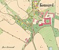 Konojedy COSK 1843.jpg 2,647 × 2,247; 1.71 MB
-
 Kostel sv Bartoloměje Vyšehradská stabilní katastr.png 797 × 520; 1.06 MB
-
 Kralupy cadasttral map 1840 det.jpg 3,000 × 1,921; 1.95 MB
-
 Kralupy cadasttral map 1840.jpg 3,000 × 1,938; 1.29 MB
-
 KrasnaHora1839.jpg 3,435 × 1,885; 4.13 MB
-
 Krzenitz COSK 1837.jpg 1,999 × 2,999; 1.78 MB
-
 Kyselka na císařských otiscích.jpg 982 × 497; 268 KB
-
 Kůsovská huť katastr.mapa.jpg 1,411 × 665; 188 KB
-
 Levonice 1843.jpg 850 × 856; 129 KB
-
 Lhota u Dubé 2022 (028).jpg 2,694 × 2,021; 1.52 MB
-
 Lobeč cadasttral map 1840 community.jpg 3,000 × 2,307; 1.95 MB
-
 Lobeč cadasttral map 1840.jpg 4,000 × 2,986; 3.36 MB
-
 Lobeček cadasttral map 1840 community.jpg 2,000 × 3,000; 1.25 MB
-
 Lobeček cadasttral map 1840.jpg 3,265 × 4,000; 3.34 MB
-
 Louny, plán města na císařském otisku mapy stabilního katastru, 1843.png 4,181 × 2,603; 669 KB
-
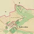 Malleschitz COSK 1841 detail 2.jpg 3,000 × 3,000; 2.34 MB
-
 Malleschitz COSK 1841 detail.jpg 3,000 × 2,000; 1.79 MB
-
 Malleschitz COSK 1841.jpg 3,000 × 2,000; 1.59 MB
-
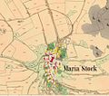
 Mlada IS 1842 St Katharina.jpg 2,000 × 1,500; 1.31 MB
-
 Mlada IS 1842-006.jpg 3,000 × 4,000; 5.43 MB
-
 Mlýn pod Radkovcem 1838.jpg 1,085 × 674; 163 KB
-
 Mlýn v Malém Mlýnku pod Kochánovem 1838.jpg 932 × 580; 97 KB
-
 Naučná stezka Milíčov 6 - Milíčovské rybníky, mapka.jpg 3,264 × 2,448; 1.35 MB
-
 Nechyba COSK 1841.jpg 4,000 × 2,641; 2.5 MB
-
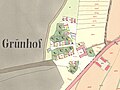
 Neuhof OMSK 1838.jpg 3,000 × 2,414; 3.08 MB
-
 Nova Hospoda COSK-01.jpg 4,000 × 4,000; 3.57 MB
-
 Nova Hospoda COSK-detail.jpg 4,000 × 3,000; 2.5 MB
-
 Novoměstské hradby v místech hlavního nádraží 1842.jpg 1,010 × 857; 199 KB
-
 Náměstí Ve Starém Hloubětíně.jpg 924 × 616; 282 KB
-
 Obec Kochánov 1838.jpg 1,276 × 1,013; 279 KB
-
 Old cadastral map of Praha-Josefov and surround areas.jpg 3,328 × 2,976; 4.73 MB
-
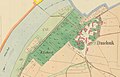
 Opatovice Praha SK.jpg 2,452 × 2,140; 3.69 MB
-
 Pardubice COSK 1839.jpg 4,000 × 2,266; 3.43 MB
-
 Pardubice RSK 1872.jpg 4,000 × 2,378; 4.39 MB
-
 Pašijová cesta Římov.png 746 × 616; 617 KB
-
 Petschau COSK 1841.jpg 3,999 × 3,999; 5.15 MB
-
 Petschau Oberer Mühlbach 1841.jpg 5,000 × 4,000; 6.95 MB
-
 Pila a mlýn pod Lipničkou (Františkodol) 1838.jpg 1,528 × 915; 287 KB
-
 Popovice u Jičína.png 643 × 582; 349 KB
-
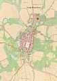
 Prachatice SK 1837 (6076-1-004).jpg 2,400 × 2,400; 2.25 MB
-
 Prachatice SK 1837 centrum.jpg 2,400 × 2,400; 2.42 MB
-
 Praha Janské náměstí 1852.jpg 1,922 × 1,281; 1.05 MB
-
 Praha SK 6068-1-005.jpg 1,700 × 2,886; 2.53 MB
-
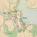 Putim COSK 1837.jpg 3,000 × 3,000; 2.92 MB
-
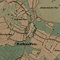 Rothsaifen OMSK 1837.jpg 3,000 × 3,000; 2.57 MB
-
 Sazau COSK 1841 detail.jpg 4,000 × 2,946; 3.56 MB
-
 Sazau COSK 1841.jpg 4,000 × 3,699; 3.65 MB
-
 Schwarzbuda COSK 1841 detail.jpg 2,713 × 3,000; 2.78 MB
-
 Schwarzbuda COSK 1841.jpg 2,632 × 3,000; 2.12 MB
-
 Skica podoby vesnice 1842.png 671 × 708; 765 KB
-
 Skoky cadastral map 1841.jpg 1,024 × 901; 785 KB
-
 Snímek obrazovky 2021-01-29 172918.png 1,385 × 855; 1.37 MB
-
 Stadt Königsaal COSK 1840.jpg 3,000 × 1,904; 1.94 MB
-
 Stadt Mnischek COSK 1840 detail.jpg 3,000 × 2,385; 2.92 MB
-
 Stadt Mnischek COSK 1840.jpg 2,996 × 3,995; 4.22 MB
-
 Stadt Moldautein COSK 1828 detail.jpg 4,000 × 3,000; 3.73 MB
-
 Stadt Moldautein COSK 1828.jpg 3,000 × 2,000; 2.03 MB
-
 Stadt Teplitz COSK 1842 detail.jpg 2,400 × 2,400; 2.57 MB
-
 Stadt Teplitz COSK 1842.jpg 3,000 × 3,000; 3.56 MB
-
 Stará Lysá 1842 Alžbětín.jpg 1,445 × 1,084; 499 KB
-
 Stará Lysá 1842 Bon Repos det.jpg 2,792 × 2,792; 2.56 MB
-
 Stará Lysá 1842 Bon Repos.jpg 3,000 × 1,500; 1.38 MB
-
 Stará Lysá 1842 community.jpg 4,394 × 5,858; 6.6 MB
-
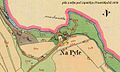
 Stará Lysá 1842 Na Pahorku.jpg 2,609 × 2,609; 1.69 MB
-
 Stará Lysá 1842 Na Vsi.jpg 3,000 × 3,000; 2.34 MB
-
 Stará Lysá cadastral map 1842.jpg 4,000 × 3,710; 3.84 MB
-
 Staré Holešovice stabilní katastr 1840.jpg 1,026 × 768; 247 KB
-
 StNikolay COSK 1839.jpg 3,000 × 4,000; 2.38 MB
-
 Susice COSK 1837.jpg 4,000 × 3,700; 4.51 MB
-
 Svatobor COSK 1842 Sauerbrun.jpg 2,543 × 1,486; 759 KB
-
 Trebon COSK 1827 detail.jpg 3,000 × 3,000; 2.72 MB
-
 Trebon COSK 1827.jpg 3,000 × 2,250; 2.21 MB
-
 Tynec nad Labem COSK 1839.jpg 4,000 × 3,525; 3.71 MB
-
 U Lužického semináře SK.jpg 1,333 × 1,639; 1.2 MB
-
 Ustek COSK 1843.jpg 4,000 × 2,201; 3.51 MB
-
 Ustek RSK.jpg 4,000 × 2,097; 4.6 MB
-
 Velký vrch císařský otisk.jpg 386 × 314; 25 KB
-
 Veltrusy stabilní katastr 1840.jpg 5,979 × 7,972; 9.38 MB
-
 Volary CO 1837.jpg 3,625 × 4,000; 4.43 MB
-
 Volary seniky 1837.jpg 2,000 × 1,988; 1.39 MB
-
 Volary VPR 1837.jpg 2,000 × 4,000; 3.03 MB
-
 Zdanice COSK 1841.jpg 4,000 × 2,643; 3.15 MB
-
 Zid hrbitov melce hist mapka.jpg 2,979 × 1,646; 578 KB
-
 Zwetbau COSK 1842.jpg 3,600 × 2,400; 3.34 MB
-
 Záchlumí SK 1840.jpg 2,666 × 4,000; 3.61 MB
-
 Šestajovická, stabilní katastr 1841.jpg 1,378 × 919; 510 KB


.jpg)


.jpg)


_1838.jpg)

.jpg)


