Category:19th-century maps of Bohemia
Jump to navigation
Jump to search
Subcategories
This category has only the following subcategory.
M
Media in category "19th-century maps of Bohemia"
The following 47 files are in this category, out of 47 total.
-
 Elbogner Dan Saatzer Kreis Und Egerische-Gebiet.jpg 7,593 × 5,687; 14.49 MB
-

-
 Das Lausitzer Gebirge und die umliegenden Gegenden.jpg 7,373 × 6,029; 17.54 MB
-
 Statistisch-topographische Finanz-Karte des Königreiches Boehmen.jpg 11,819 × 8,829; 13.47 MB
-
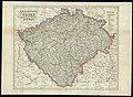
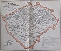
 Mapa království českého 1847.jpg 2,633 × 2,343; 1.95 MB
-
 1850 Perthes Map of Bohemia ( Czech Republic ) - Geographicus - Boheme-perthes-1850.jpg 4,000 × 3,304; 3.58 MB
-
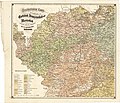
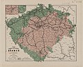
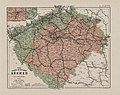
 Königreich Böhmen nach Kreisen 1850.jpg 4,320 × 3,240; 1.92 MB
-
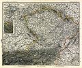
 Süd-Östliches Deutschland, enthält die Oesterreichischen Lande.jpg 1,681 × 1,987; 1.12 MB
-
 Geognostische Karte der Umgebungen von Carlsbad, Franzensbad und Marienbad (retuschiert).jpg 2,848 × 2,448; 7.78 MB
-
 Geognostische Karte der Umgebungen von Carlsbad, Franzensbad und Marienbad.jpg 2,876 × 2,472; 1.78 MB
-
 1862 Perthes Map of Bohemia and Austria - Geographicus - DeutschlandSE-perthes-1862.jpg 3,036 × 2,551; 2.27 MB
-
 Archiv für die naturwissenschaftliche Landesdurchforschung von Böhmen (1915) (20139638620).jpg 7,196 × 5,436; 13.14 MB
-

-
 Kralovstvi Ceske 1877.jpg 18,293 × 13,391; 61.28 MB
-
 185 of 'Geschichte der königlichen Stadt Karlsbad, etc' (11164431373).jpg 2,496 × 1,592; 1.13 MB
-
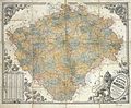 Erbenova mapa Čech (1883).jpg 2,870 × 2,361; 2.64 MB
-
 297 of 'Die Hohenzollern und das Reich, etc' (11167783114).jpg 2,640 × 1,716; 1.55 MB
-
 Meyers b3 s0134a.jpg 2,048 × 1,586; 1.01 MB
-
 Archiv für die naturwissenschaftliche Landesdurchforschung von Böhmen (1887) (19705245604).jpg 1,718 × 2,808; 1,011 KB
-

-

-
 Neueste Eisenbahn-und Strassenkarte - von Böhmen von J. E. Wagner - btv1b530581840.jpg 7,515 × 6,155; 7.2 MB
-
-
 Neueste Handkarte von Böhmen (2te ergänzte Auflage) - von J. E. Wagner - btv1b530251557.jpg 9,739 × 6,069; 9.17 MB
-

-
 Stielers Handatlas 1891 18.jpg 5,100 × 4,250; 8.47 MB
-
 Meyers leiner Hand-atlas 1893 (73136732).jpg 6,494 × 5,017; 8.58 MB
-
 Ottův slovník naučný - 10 Církevní mapa.jpg 2,050 × 1,738; 2.22 MB
-
 Ottův slovník naučný - 2 Geologická mapa.jpg 2,408 × 1,810; 2.92 MB
-
 Historicka mapa Cech 14 stol.jpg 6,407 × 5,338; 12.3 MB
-

-
 Böhmen.jpg 5,475 × 4,477; 7.2 MB
-
 Charte vom Konigreich Boheim F.L. Güssefeld 1804.jpg 14,813 × 12,420; 37.71 MB
-
 Feldzug 1757. Erste Periode, von Mitte April bis zum 6ten Mai. Operationen in Boehmen.jpg 8,268 × 5,405; 6.59 MB
-

-
 General-Post und Straßen-Karte des Konigreichs Böhmen 1889.jpg 9,292 × 6,261; 9.36 MB
-
 Johann Georgenstadt.jpg 7,431 × 6,603; 14.57 MB
-
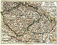
 Karte des Königreiches Böhmen nach der Eintheilung vom Jahre 1854 01.jpg 9,897 × 7,621; 25.9 MB
-
 Ottův slovník naučný - 1 Mapa výšek.jpg 2,083 × 1,714; 2.45 MB
-
 Ottův slovník naučný - 11 Mapa škol.jpg 2,032 × 1,727; 2.18 MB
-
 Ottův slovník naučný - 18 Politický přehled.jpg 2,209 × 1,875; 3.12 MB
-
 Ottův slovník naučný - 3 Mapa zalidněnosti.jpg 2,246 × 1,835; 2.81 MB
-
 Ottův slovník naučný - 8 Mapa sídel velkoprůmyslu zemědělského.jpg 2,150 × 1,804; 2.43 MB
-
 Ottův slovník naučný - 9 Mapa sídel velkoprůmyslu továrního.jpg 2,436 × 1,326; 2.12 MB
-
 Palackeho mapa Cech.jpg 14,194 × 11,669; 38.17 MB
-
 Spezialkarte Pisek und Blatna.jpg 5,748 × 4,422; 21.5 MB
-
 Uibersichts- Post- u. Strassen-Karte des Königreiches Böhmen.jpg 7,782 × 6,465; 19.74 MB


_-_Geographicus_-_Boheme-perthes-1850.jpg)


.jpg)


_(20139638620).jpg)
_(20301582936).jpg)

.jpg)
.jpg)
.jpg)

_(19705245604).jpg)
_(20327907505).jpg)
_(20333933251).jpg)


_-_von_J._E._Wagner_-_btv1b530251557.jpg)
.jpg)

.jpg)


%27_(11243129373).jpg)


