Category:Maps of the Enceinte de Charles V
Jump to navigation
Jump to search
Subcategories
This category has only the following subcategory.
M
Media in category "Maps of the Enceinte de Charles V"
The following 46 files are in this category, out of 46 total.
-
 Plan de Paris vers 1550 porte St-Martin.jpg 677 × 356; 344 KB
-
 Ville, Cite et Universite de Paris.jpg 4,693 × 3,865; 10.53 MB
-

-

-

-
-

-
-
 Enceinte de Charles V près du bastion du Temple en 1620.png 549 × 433; 635 KB
-
 Enceinte de Charles V près du Temple vesr 1530 sur plan de St-Victor.png 538 × 475; 338 KB
-
 Enceinte de Charles V sur plan de St-Victor.png 538 × 467; 333 KB
-
 Enceintes de Charles V et des Fossés jaunes en 1609 (plan Quesnel).png 1,153 × 502; 947 KB
-
-
 Henri Dron & Heymann, Plan de la Commune de Paris - Paris Musées.jpg 7,790 × 6,029; 29.14 MB
-
 Jardin et Palais des Tuileries, 1585.jpg 3,819 × 2,726; 6.53 MB
-
 L'enceinte de Charles V - ALPAGE.svg 1,121 × 1,001; 7.35 MB
-
 Le Palais Royal et ses environs 1500-1648.jpg 3,500 × 2,723; 5.75 MB
-
 Limites des interdictions de bâtir aux 17e-18e siècle - ALPAGE.pdf 1,752 × 1,239; 321 KB
-
 March approach to Paris by Joan of Arc (September 1429).jpg 2,049 × 2,742; 2.07 MB
-
 March approach to Paris by Joan of Arc and the Lord of Saint-Vallier (September 1429).jpg 2,007 × 2,524; 1.43 MB
-
 Mur de fortification sur plan Truchet et Hoyaux vers 1550.png 541 × 461; 343 KB
-
 Mur de fortification sur plan Truschet et Hoyau vers 1550.png 382 × 488; 532 KB
-
 Mur de fortification vers 1530 sur plan de Saint-Victor.png 474 × 534; 674 KB
-
 Mur de fortifications sur plan Braun vers 1530.png 615 × 522; 891 KB
-
 ParisCharlesV.jpg 1,600 × 1,242; 802 KB
-
 Paroisses personnelles du Moyen Âge à 1790 - ALPAGE.pdf 1,752 × 1,239; 304 KB
-
 Plan de Paris vers 1530 Braun Paris HAAB tour de Billy.jpg 473 × 411; 244 KB
-
 Plan de Paris vers 1530 Braun Paris Porte St-Honore.jpg 662 × 471; 380 KB
-
 Plan de Paris vers 1550 color tour de Billy disparue.jpg 600 × 544; 371 KB
-
 Plan de Paris vers 1550 porte du Temple.jpg 663 × 544; 535 KB
-
 Plan de Paris vers 1550 porte Montmartre.jpg 709 × 480; 500 KB
-
 Plan de Paris vers 1550 porte St-Antoine.jpg 657 × 556; 485 KB
-
 Plan de Paris vers 1550 porte St-Denis.jpg 738 × 388; 400 KB
-
 Plan de Paris vers 1550 porte St-Honore.jpg 463 × 446; 302 KB
-
 Plan de Paris vers 1550 Rue Montmartre.jpg 902 × 665; 890 KB
-
 Plan des anciennes enceintes de Paris (1180-1845) - Paris Musées.jpg 9,262 × 6,876; 40.55 MB
-

-
 Plan des anciennes enceintes et limites de Paris, Etabli par A. Grimault (02) - Paris Musées.jpg 8,463 × 6,108; 31.94 MB
-
 Plan des anciennes enceintes et limites de Paris, Etabli par A. Grimault (03) - Paris Musées.jpg 8,216 × 6,152; 32.71 MB
-
 Porte Saint-Louis sur plan Janssonius (vers 1650).png 460 × 413; 576 KB
-
 Réactualisation des sites ecclésiastiques de 500 à 1790 - ALPAGE.pdf 1,752 × 1,239; 308 KB
-
-
 The city limits of Paris from the 4th century to 2015.svg 1,500 × 1,000; 24 KB
-
 Wall of Charles V - ALPAGE.pdf 2,700 × 2,700; 3.2 MB
-
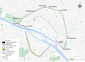
 Wall of Charles V - ALPAGE.svg 512 × 364; 2.22 MB
-
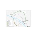
 Wall of Charles V - OSM 2020.svg 2,200 × 1,600; 4.08 MB


.png)


.jpg)
.jpg)


_-_Paris_Mus%C3%A9es.jpg)
_-_Paris_Mus%C3%A9es.jpg)
_-_Paris_Mus%C3%A9es.jpg)
_-_Paris_Mus%C3%A9es.jpg)
.png)


