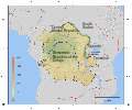
Category:Maps of the Congo Drainage basin
Jump to navigation
Jump to search
Subcategories
This category has the following 2 subcategories, out of 2 total.
M
- Maps of the Ebola River (2 F)
Media in category "Maps of the Congo Drainage basin"
The following 20 files are in this category, out of 20 total.
-
Aruwimi-Ituri.png 1,150 × 956; 751 KB
-
CongoLualaba watershed plain political.png 1,150 × 956; 213 KB
-
CongoLualaba watershed plain.png 1,150 × 956; 114 KB
-
CongoLualaba watershed topo political.png 1,150 × 956; 815 KB
-
CongoLualaba watershed topo.png 1,150 × 956; 768 KB
-
Congo-Nile Divide.svg 1,150 × 956; 1.09 MB
-
Congo-Nile Divide2.png 2,464 × 2,049; 2.01 MB
-
Congobasinmap.png 3,007 × 2,996; 11.11 MB
-
Kasai River Catchment OSM.png 1,577 × 1,892; 5.12 MB
-
Kasai watershed.png 1,190 × 889; 878 KB
-
Likouala Basin.png 2,698 × 2,523; 10.31 MB
-
Luava Luapula Chambeshi OSM.png 1,051 × 1,051; 1.76 MB
-
Malagarasi OSM.png 3,154 × 2,600; 11.06 MB
-
Originalkarte des Gebietes der Muschi-Congo im portugiesischen West-Afrika.png 4,317 × 2,494; 13.96 MB
-
Rivers of center DRC.png 1,226 × 1,226; 2.48 MB
-
Rivers of the east DRC OSM.png 1,517 × 2,197; 6.24 MB
-
Sanghabasinmap.png 1,441 × 1,793; 1.97 MB
-
Ubangirivermap.png 996 × 767; 1.16 MB
-
Бассейн Конго.png 645 × 575; 484 KB


