Category:Maps of the Canterbury Region
Jump to navigation
Jump to search
Regions of New Zealand: Auckland · Bay of Plenty · Canterbury · Hawke's Bay · Marlborough · Nelson · Otago · Southland · Tasman · Waikato · Wellington · West Coast
Outlying islands, territories and dependencies: Auckland Islands · Chatham Islands · Kermadec Islands · Tokelau – Territory with specific status: Ross Dependency
Associated countries: Cook Islands · Niue
Outlying islands, territories and dependencies: Auckland Islands · Chatham Islands · Kermadec Islands · Tokelau – Territory with specific status: Ross Dependency
Associated countries: Cook Islands · Niue
| NO WIKIDATA ID FOUND! Search for Maps of the Canterbury Region on Wikidata | |
| Upload media |
Subcategories
This category has the following 3 subcategories, out of 3 total.
- Maps of Lyttelton (1 F)
Media in category "Maps of the Canterbury Region"
The following 6 files are in this category, out of 6 total.
-
 Admiralty Chart No 1575 Akaroa Harbour , Published 1844.jpg 5,163 × 7,112; 9.42 MB
-
 Admiralty Chart No 1575 Akaroa Harbour, Published 1874, Large Corrections 1935.jpg 6,316 × 8,272; 15.18 MB
-
 Admiralty Chart No 1694 Wakaroa, Published 1845.jpg 3,822 × 5,442; 2.94 MB
-

-
 Admiralty Chart No 2178 Banks Peninsula, Published 1853.jpg 5,361 × 7,156; 4.68 MB
-
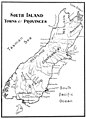 Emerald Hours in New Zealand (1906) · Lowth · 117.jpg 1,522 × 2,113; 254 KB


_and_Levy_(Koko-Rarat)_and_Pigeon_(Wakaroa)_Survey_By_Captain_J.L._Stokes_R.N._1849,_Published_1850,_Corrections_to_1865.jpg)

_%C2%B7_Lowth_%C2%B7_117.jpg)