Category:Maps of the Borough of Swindon
Jump to navigation
Jump to search
Media in category "Maps of the Borough of Swindon"
The following 29 files are in this category, out of 29 total.
-
 Borough of swindon - historic sites.png 1,260 × 1,385; 109 KB
-
 Borough of swindon - main transport routes.png 1,260 × 1,385; 106 KB
-
 Borough of swindon - urban areas with names.png 1,260 × 1,385; 68 KB
-
 Borough of swindon - urban areas.png 1,260 × 1,385; 59 KB
-
 EnglandSwindon.png 200 × 247; 26 KB
-
 NorthSwindonConstituency.svg 180 × 242; 39 KB
-
 SouthSwindonConstituency.svg 180 × 242; 39 KB
-
 SWINDON (49911034812).png 2,160 × 1,080; 308 KB
-
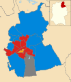
 Swindon 2006 election map.png 425 × 480; 50 KB
-
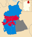
 Swindon 2007 election map.png 425 × 480; 52 KB
-
 Swindon 2008 election map.png 425 × 480; 49 KB
-
 Swindon UK local election 2000 map.svg 1,102 × 1,266; 365 KB
-
 Swindon UK local election 2002 map.svg 1,102 × 1,266; 364 KB
-
 Swindon UK local election 2003 map.svg 1,102 × 1,266; 364 KB
-
 Swindon UK local election 2004 map.svg 1,102 × 1,266; 364 KB
-
 Swindon UK local election 2008 map.svg 1,102 × 1,266; 365 KB
-
 Swindon UK local election 2010 map.svg 1,102 × 1,266; 364 KB
-
 Swindon UK local election 2011 map.svg 1,102 × 1,266; 364 KB
-
 Swindon UK local election 2012 map.svg 1,102 × 1,266; 382 KB
-
 Swindon UK local election 2014 map.svg 1,102 × 1,266; 382 KB
-
 Swindon UK local election 2015 map.svg 1,102 × 1,266; 382 KB
-
 Swindon UK local election 2016 map.svg 1,102 × 1,266; 382 KB
-
 Swindon UK local election 2018 map.svg 1,102 × 1,266; 382 KB
-
 Swindon UK local election 2019 map.svg 1,102 × 1,266; 382 KB
-
 Swindon UK local election 2021 map.svg 1,102 × 1,266; 383 KB
-
 Swindon UK local election 2022 map.svg 1,102 × 1,266; 383 KB
-
 Swindon UK locator map.svg 1,039 × 1,266; 741 KB
-
 Swindon UK ward map 2010 (blank).svg 1,102 × 1,266; 364 KB
-
 Swindon UK ward map 2012 (blank).svg 1,102 × 1,266; 382 KB


.png)


.svg)
.svg)