Category:Maps of Swindon
Jump to navigation
Jump to search
Media in category "Maps of Swindon"
The following 14 files are in this category, out of 14 total.
-
 Ordnance Survey Drawings - Swindon (OSD 166).jpg 3,749 × 5,751; 3.56 MB
-
 Extract of Ordnance Survey Map SU18.jpg 1,743 × 2,375; 3.27 MB
-
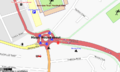 MagicRounderboutSwindon.png 793 × 478; 156 KB
-
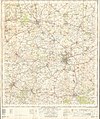
 Ordnance Survey One-Inch Sheet 104 Swindon & Cirencester, Published 1919.jpg 11,919 × 8,835; 9.81 MB
-
 Ordnance Survey One-Inch Sheet 157 Swindon, Published 1940.jpg 8,198 × 9,537; 10.75 MB
-
 Ordnance Survey One-Inch Sheet 157 Swindon, Published 1958.jpg 8,326 × 9,940; 10.27 MB
-
 Ordnance Survey One-Inch Sheet 157 Swindon, Published 1968.jpg 8,365 × 9,905; 10.54 MB
-
 Swindon in the UK.png 329 × 491; 40 KB
-
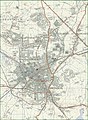
 Swindon map 1945.jpg 1,173 × 833; 146 KB
-
 Swindon marlborough.png 400 × 500; 263 KB
-
 Swindon UK ward map 2024.svg 1,102 × 1,266; 385 KB
-
 Swindon unparished area UK locator map.svg 1,102 × 1,266; 364 KB
-
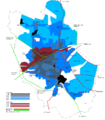 Swindon urban growth.png 1,100 × 1,261; 80 KB
-
 Swindonmap 1933.jpg 1,360 × 1,152; 224 KB
.jpg)


