Category:Maps of the Borough of Elmbridge
Jump to navigation
Jump to search
Media in category "Maps of the Borough of Elmbridge"
The following 12 files are in this category, out of 12 total.
-
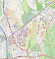
Brooklands street map, 23 Jan 2014.PNG 813 × 874; 311 KB
-
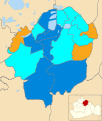
Elmbridge UK local election 2021 map.svg 1,075 × 1,266; 342 KB
-
Elmbridge UK locator map.svg 1,425 × 1,081; 948 KB
-
Elmbridge UK ward map 2010 (blank).svg 1,075 × 1,266; 257 KB
-
Elmbridge UK ward map 2016 (blank).svg 1,075 × 1,266; 341 KB
-
Elmbridge UK ward map 2023.svg 1,075 × 1,266; 342 KB
-
Elmbridge unparished area UK locator map.svg 1,075 × 1,266; 183 KB
-
Elmbridge.png 910 × 706; 315 KB
-
Growltiger Placenames.svg 689 × 274; 200 KB
-
Hersham.png 1,280 × 800; 476 KB
-
Map of Surrey Sheet 012, Ordnance Survey, 1871-1882.jpg 10,759 × 7,179; 18.63 MB
-
SurreyElmbridge.png 200 × 142; 13 KB


