Category:Maps of the Bering Strait
Jump to navigation
Jump to search
Subcategories
This category has only the following subcategory.
O
- Old maps of the Bering Strait (13 F)
Media in category "Maps of the Bering Strait"
The following 14 files are in this category, out of 14 total.
-
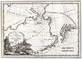 1798 Cassini Map of Alaska and the Bering Strait - Geographicus - Alaska-cassini-1798.jpg 4,000 × 2,897; 3.09 MB
-

-
 Berengia - present day.png 269 × 371; 11 KB
-
 Bering Strait depth.gif 526 × 350; 21 KB
-
 Bering Strait in its region.svg 500 × 281; 4.82 MB
-
 Beringia, 1967.jpg 1,953 × 2,885; 2.19 MB
-
 Beringlandbrug - ontgletsjeringsperiode-nl.png 269 × 371; 26 KB
-
 Beringlandbrug - vandaag.png 269 × 371; 13 KB
-
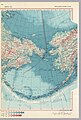
 BeringStrait.png 1,840 × 2,608; 1.04 MB
-
 Chukchi Sea map ar.png 1,202 × 675; 229 KB
-
 DIOMEDE BRIDGE MAP.jpg 3,508 × 2,480; 1.43 MB
-
 Operational Navigation Chart C-8, 2nd edition.jpg 9,060 × 6,634; 14.37 MB
-
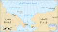
 US NOAA nautical chart of Bering Strait.png 597 × 422; 30 KB
-
 Чукотско море.png 896 × 570; 160 KB

_(19173970770).jpg)


