Category:Maps of the Bering Sea
Jump to navigation
Jump to search
Subcategories
This category has the following 4 subcategories, out of 4 total.
B
M
O
~
Media in category "Maps of the Bering Sea"
The following 50 files are in this category, out of 50 total.
-
 Chart of the Northern Passage Between Asia & America.jpg 15,190 × 12,891; 19.52 MB
-

-

-
 Admiralty Chart Catalogue 1967 Page 092 Index Q.jpg 8,572 × 6,889; 7.59 MB
-
 Admiralty Chart No 2460 Kamchatka to San Francisco, Published 1942, Large Corrections 1960.jpg 17,721 × 11,259; 53.78 MB
-
 Alaska Ranger sinking site.jpeg 959 × 827; 38 KB
-
 Anadyr chart.gif 840 × 730; 47 KB
-
 Bering Sea (Japanese).png 1,376 × 1,032; 357 KB
-
 Bering Sea Aleutian Is Alaska map.png 1,457 × 1,277; 2.04 MB
-
 Bering Sea Location.png 700 × 375; 116 KB
-
 Bering Shape.svg 600 × 313; 489 KB
-
 Beringia, 1967.jpg 1,953 × 2,885; 2.19 MB
-
 Beringmeer-Aleuten-Karte.png 1,457 × 1,281; 2.04 MB
-
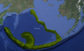
 Blue King Crab Distribution.png 586 × 457; 224 KB
-
 Cape Chukotsky region.PNG 766 × 507; 788 KB
-
 Cape Dezhnev USCGS 1937.PNG 816 × 357; 567 KB
-
 Cape Prince of Wales.png 433 × 550; 19 KB
-
 Carte de l'Entrée de Norton, et du Détroit de Bhering (19577128461).jpg 6,224 × 3,968; 3.95 MB
-
 Carte de la Côte N.O. de L'Amérique et de la Côte N.E. de L'Asie (19572835115).jpg 7,752 × 4,840; 6.02 MB
-
 Chukchi SeaOnemen.png 729 × 484; 51 KB
-
 Etolin Strait.PNG 845 × 505; 731 KB
-
 Kanchalan.png 421 × 486; 6 KB
-
 LA2-Bering-Sea-UTM-zones.png 960 × 516; 103 KB
-
 LA2-Bering-Sea.png 960 × 516; 110 KB
-
 Location of Provideniya Bay (corrected format).PNG 206 × 123; 3 KB
-

-

-
 Northern Bering Sea Climate Resilience Area - Executive Order Map.pdf 1,275 × 1,650; 793 KB
-
 Oblique Map of the Bering Sea, 1974.jpg 5,043 × 3,970; 2.48 MB
-
 Operational Navigation Chart C-8, 2nd edition.jpg 9,060 × 6,634; 14.37 MB
-
 Operational Navigation chart D-10, 4th edition.jpg 9,254 × 6,676; 12.95 MB
-
 Operational Navigation chart D-9, 5th edition.jpg 9,254 × 6,671; 15.84 MB
-
 Operational Navigation Chart E-11, 4th edition.jpg 9,254 × 6,772; 8.08 MB
-
 Operational Navigation Chart E-12, 3rd edition.jpg 9,254 × 6,728; 7.61 MB
-
 Operational Navigation Chart E-13, 2nd edition.jpg 9,254 × 6,792; 6.99 MB
-
 Pohjoinen jäämeri - Beringinmeri - Tyyni valtameri.png 2,398 × 1,800; 2.57 MB
-
 Providence Bay Region 1928.PNG 751 × 443; 634 KB
-
 Provideniya Region.PNG 692 × 343; 405 KB
-
 ProvideniyaLocator.PNG 640 × 474; 104 KB
-
 Provideniyaregion.PNG 711 × 339; 412 KB
-
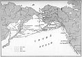 Routes of I.G. Voznesensky travels.jpg 1,746 × 1,206; 495 KB
-
 The American Museum journal (c1900-(1918)) (17539066353).jpg 2,992 × 1,604; 797 KB
-

-
 The Soviet Union 1957 CPA 1977 stamp (Vitus Bering and Map of his Explorations).jpg 2,015 × 1,467; 1.66 MB
-
 Voyages of Ilya Voznesensky (1840-1848) - es.svg 1,482 × 1,086; 1,011 KB
-
 Voyages of Ilya Voznesensky (1840-1848) - ru.svg 1,482 × 1,086; 913 KB
-
 Útbreiðsla.png 1,210 × 733; 1.59 MB
-
 Берингово море залив Корфа.png 920 × 480; 795 KB
-
 БСЭ1. Берингово море.jpg 1,901 × 1,289; 1.41 MB
-
 Карта Восточного океана, 1851.jpg 3,328 × 2,000; 441 KB

.jpg)


.png)


.jpg)
.jpg)


.PNG)


)_(17539066353).jpg)
_(21107470466).jpg)
.jpg)
_-_es.svg)
_-_ru.svg)


.jpg)