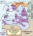
Category:Maps of the Baltics in the 13th century
Jump to navigation
Jump to search
English: This category is about the subject of the Baltics 1201-1300 CE: History maps showing all or a substantial part of the Baltics as it was in the 13th century.
Contemporary old maps belong into: Category:Old maps of the Baltics and its subcategories.
Contemporary old maps belong into: Category:Old maps of the Baltics and its subcategories.
Subcategories
This category has only the following subcategory.
Media in category "Maps of the Baltics in the 13th century"
The following 15 files are in this category, out of 15 total.
-
2nd Prussian uprising.svg 1,500 × 1,180; 360 KB
-
Deutscher Orden 1260+Farb.png 1,200 × 1,043; 436 KB
-
Livland 1260.png 1,909 × 2,068; 576 KB
-
Livland 1260.svg 955 × 1,034; 790 KB
-
Medieval Livonia 1260.svg 955 × 1,034; 734 KB
-
Teutonic Order 1260.png 1,200 × 1,043; 814 KB
-
Ливонская Конфедерация 1260.png 600 × 650; 192 KB
-
Ordensstaat-kirchlich.jpg 539 × 539; 78 KB
-
Altpreußische Landschaften im 13. Jahrhundert.png 900 × 634; 252 KB
-
Deutscher Orden 1260.png 1,200 × 1,043; 857 KB
-
Grand Duchy of Lithuania in 1270.jpg 800 × 651; 445 KB
-
Mapa d'Estonia.png 634 × 650; 158 KB
-
Positionskarte EE + LV 1260.png 794 × 861; 120 KB
-
Prūsų žemės XIII amžiuje.svg 1,790 × 1,260; 769 KB


