Category:Maps of Germany in the 13th century
Jump to navigation
Jump to search
English: This category is about the subject of  Germany 1201-1300 CE: History maps showing all or a substantial part of the territory of Germany as it was in the 13th century.
Contemporary old maps belong into: Category:13th-century maps of Germany and its subcategories.
Contemporary old maps belong into: Category:13th-century maps of Germany and its subcategories.
Maps of the history of Germany: (BCE) (CE) 8th century · 9th century · 10th century · 11th century · 12th century · 13th century · 14th century · 15th century · 16th century · 17th century · 18th century · 19th century · 20th century · 21st century ·
Media in category "Maps of Germany in the 13th century"
The following 13 files are in this category, out of 13 total.
-
 Modern history; Europe (1904) (14765420362).jpg 2,056 × 3,032; 1.86 MB
-
 Atlas of European history (1909) (14803830803).jpg 2,166 × 3,608; 1.64 MB
-
 Bremen 13.Jh. Dilich 1604 (Detail).jpg 850 × 595; 441 KB
-
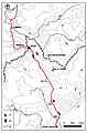 Karte Handelsweg Brandau rot.jpg 964 × 1,459; 288 KB
-
 Karte Handelsweg Brandau.jpg 964 × 1,459; 282 KB
-
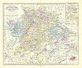
 Spruner-Menke Handatlas 1880 Karte 38.jpg 10,321 × 8,657; 18.6 MB
-
 Spruner-Menke Handatlas 1880 Karte 39.jpg 10,401 × 8,785; 19.64 MB
-
 Spruner-Menke Handatlas 1880 Karte 40.jpg 10,449 × 8,737; 19.47 MB
-
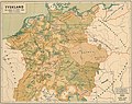 Tyskland i slutet av 1200-talet.jpg 3,510 × 2,770; 2.92 MB
-

-

-

-

_(14765420362).jpg)
_(14803830803).jpg)
.jpg)


.jpg)
.jpg)
.jpg)
.jpg)