Category:Maps of the Alaska-Yukon-Pacific Exposition
Jump to navigation
Jump to search
English: Several of these maps, while quite detailed, predate the fair itself and are not particularly accurate for what buildings were actually constructed, nor for exactly what some of these buildings were used for. File:You'll like Tacoma - official map of the A.Y.P.E. grounds - Map.jpg appears to be the most accurate, though not the most detailed.
Subcategories
This category has only the following subcategory.
Media in category "Maps of the Alaska-Yukon-Pacific Exposition"
The following 13 files are in this category, out of 13 total.
-
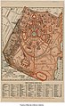 A-Y-P map with legend.jpg 631 × 1,030; 181 KB
-
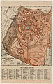
 A-Y-P map.jpg 600 × 709; 88 KB
-
 Alaska-Yukon-Pacific Exposition - Seattle, June 1-October 16, 1909 - Page 46.jpg 2,871 × 4,740; 3.28 MB
-

-

-
 Exposition beautiful - Map.jpg 3,427 × 4,786; 3.68 MB
-
 Japan exhibits building - Alaska-Yukon-Pacific Exposition, Seattle 1909 - Back cover map.jpg 2,623 × 3,564; 1.85 MB
-
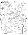
 Map of the Alaska-Yukon-Pacific Exposition, Seattle, 1909 (MOHAI 14560).jpg 1,000 × 971; 218 KB
-
-
 Sanborn A-Y-P map.jpg 1,200 × 1,522; 390 KB
-

-

-
 You'll like Tacoma - official map of the A.Y.P.E. grounds - Map.jpg 6,297 × 9,039; 37.72 MB


.jpg)


.jpg)
.jpg)


_(14572234097).jpg)
