Category:Campus maps of the United States
Jump to navigation
Jump to search
English: Maps of educational, business, and other campuses in the United States
Subcategories
This category has the following 8 subcategories, out of 8 total.
Media in category "Campus maps of the United States"
The following 117 files are in this category, out of 117 total.
-
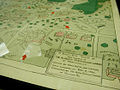 "Birds-Eye View" Map (2784738136).jpg 1,120 × 840; 852 KB
-
 "Birds-Eye View" Map (detail) (2784738130).jpg 1,120 × 840; 917 KB
-
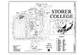 00001r Storer College Campus Map.jpg 1,024 × 683; 298 KB
-
 1896 CopleySq Boston map byStadly BPL 12479 detail.png 1,065 × 739; 1.5 MB
-

-
 2015-03-27 15 52 49 Campus map at Great Basin College in Elko, Nevada.JPG 2,448 × 3,264; 2.7 MB
-
 8thgatech.jpg 532 × 464; 73 KB
-
 Albuquerque unm map.svg 744 × 1,052; 388 KB
-
 Annalee and Winni Playhouse Campus Map.jpeg 860 × 514; 27 KB
-
-
 Auburn high campus map.png 570 × 454; 88 KB
-
 AVHSMap.jpg 5,072 × 3,083; 2.68 MB
-
 Benet Academy campus map.JPG 601 × 576; 50 KB
-
 Benet Academy Campus Map.svg 458 × 440; 795 KB
-
 Brown University map.svg 750 × 875; 358 KB
-
 BuildingonOldCampusAerialViews 009.jpg 4,764 × 4,371; 5.48 MB
-
 California a guide to the Golden state page 185.png 2,061 × 3,386; 1.07 MB
-
 Caltech campus map 1944.png 978 × 476; 522 KB
-
 Campus Map (4514614069).jpg 1,708 × 1,161; 1.32 MB
-
 CampusDirectoryUCCSsign.jpg 800 × 600; 83 KB
-
 CampusMap2011(0).jpg 680 × 829; 520 KB
-
 Central Washington University Map.jpg 4,200 × 2,550; 1.35 MB
-
 Cnr map.png 578 × 500; 707 KB
-
 Columbia University Tunnels.png 1,275 × 1,412; 764 KB
-
 Conservancy of Southwest Florida map.jpg 1,024 × 443; 468 KB
-
 Danforthcampus.png 765 × 559; 143 KB
-
 DCU site.jpg 950 × 417; 73 KB
-
 DeVilbissCampus.PNG 516 × 453; 12 KB
-
 Ernest B De Silva Elementary Map (EB-deSilva-Map).jpg 502 × 433; 42 KB
-
 Ernest B De Silva Elementary Map (EB-deSilva-Map).tiff 502 × 433; 253 KB
-
 Farragut Field 1924 crop.png 402 × 935; 243 KB
-
 Flint Cultural Center.pdf 1,650 × 1,275; 218 KB
-
 Gilman-school-campus-map-med.jpg 2,200 × 1,700; 1.36 MB
-
 Gilman-school-campus-map.jpg 4,400 × 3,400; 3.52 MB
-
 Gilman-school-map-06-24-09.jpg 2,200 × 1,700; 1.4 MB
-
 Gilman-school-map-2008-06-19.jpg 2,200 × 1,700; 1.39 MB
-
 GMU Arlington location map.svg 430 × 349; 40 KB
-
 GMU Fairfax location map.svg 776 × 450; 244 KB
-
 Great Falls High School - campus map - Great Falls Montana US - 2011.jpg 813 × 986; 125 KB
-
 Gsfc-campus.png 1,200 × 897; 696 KB
-
 Harvard University map (older, date unknown).jpg 656 × 869; 612 KB
-
 Ha‘aheo Elementary Map (Haaheo-Elementary-Map).jpg 3,300 × 2,549; 435 KB
-
 Ha‘aheo Elementary Map (Haaheo-Elementary-Map).tiff 3,300 × 2,549; 1.78 MB
-
 Hilo High School Map (Hilo-High-Map).jpg 612 × 792; 96 KB
-
 Hilo High School Map (Hilo-High-Map).tiff 612 × 792; 295 KB
-
 Hilo Intermediate School Map (Hilo-Intermediate-Map).jpg 1,004 × 609; 125 KB
-
 Hilo Intermediate School Map (Hilo-Intermediate-Map).tiff 1,004 × 609; 353 KB
-
 Hilo Union Elementary School Map (Hilo-Union-Map).jpg 3,299 × 2,550; 834 KB
-
 Hilo Union Elementary School Map (Hilo-Union-Map).tiff 3,299 × 2,550; 3.82 MB
-
 History of Rensselaer Polytechnic Institute, 1824-1914 (1914) (14580479558).jpg 2,288 × 1,344; 264 KB
-
 INL Idaho Falls Facilities.jpg 3,361 × 2,439; 525 KB
-
 Jefferson College map 1897.png 933 × 601; 1.4 MB
-
 Kalanianaole Elementary & Intermediate Map (Kalanianaole-Elementary-Map).jpg 3,300 × 2,549; 700 KB
-
 Kalanianaole Elementary & Intermediate Map (Kalanianaole-Elementary-Map).tiff 3,300 × 2,549; 3.01 MB
-
 Kapi‘olani Elementary Map (Kapiolani-Map).jpg 612 × 612; 60 KB
-
 Kapi‘olani Elementary Map (Kapiolani-Map).tiff 612 × 612; 378 KB
-
 Kaumana Elementary Map (Kaumana-Elem-Map).jpg 3,300 × 2,549; 800 KB
-
 Kaumana Elementary Map (Kaumana-Elem-Map).tiff 3,300 × 2,549; 3.64 MB
-
 Keaukaha Elementary Map (Keaukaha-Elem-Map).jpg 3,300 × 2,549; 582 KB
-
 Keaukaha Elementary Map (Keaukaha-Elem-Map).tiff 3,300 × 2,549; 2.59 MB
-
 LibbeyCampus.png 527 × 342; 13 KB
-
 Map of camp kearns.png 653 × 532; 226 KB
-
 Map of Memorial Stadium And Oak Grove.png 2,992 × 2,496; 861 KB
-
 Map of Memorial Stadium And Oak Grove.svg 898 × 749; 812 KB
-
 Map of Shootings at Kent State University in 1970.jpg 1,200 × 935; 364 KB
-
 Map of UNT athletic facilities.svg 2,036 × 2,486; 42 KB
-
-

-
 Map1924.jpg 621 × 577; 68 KB
-
 Massachusetts Agricultural College, 1912.png 910 × 554; 231 KB
-
 MSU Campus Plan1926.jpg 675 × 555; 101 KB
-
 Mosaic Community Campus map 2023-05-15.jpg 2,109 × 2,609; 735 KB
-
 MSNC map 1918.PNG 400 × 270; 190 KB
-
 MSU campus map rev2.png 996 × 846; 193 KB
-
 MSU campus map rev3.png 996 × 846; 174 KB
-
 MSU Campus Map small rev2.png 888 × 598; 143 KB
-
 MSU Campus Map small rev3.png 888 × 598; 96 KB
-
 MSU Campus Map small.png 888 × 598; 146 KB
-
 MSU campus map.png 996 × 846; 200 KB
-
 MSU Rock map.png 290 × 200; 26 KB
-
 Northeast Portland, Oregon (2019) - 174.jpg 3,000 × 4,000; 3.57 MB
-
 NSCC Plain Map 2.jpg 2,959 × 1,483; 602 KB
-
 NSCC Plain Map.jpg 2,963 × 1,496; 1.22 MB
-
 Portland Map -Oct 2007.jpeg 560 × 583; 57 KB
-
 PSM V67 D762 Street map of the university of illinois campus.png 776 × 2,149; 136 KB
-
 Rand McNally map of University of Pennsylvania campus 1915.jpg 558 × 796; 139 KB
-
 Reed College campus map, 2012.JPG 3,000 × 4,000; 2.74 MB
-
 RPI 1909 campus map.gif 1,024 × 532; 425 KB
-
 Salina Normal University map.png 523 × 491; 633 KB
-
 Satirical map of Miami University campus n.d. (3192347112).jpg 1,498 × 1,195; 290 KB
-
 Shimer college campus map 1973.jpg 2,642 × 3,067; 4.21 MB
-
 Skyline High School Campus Map.png 2,620 × 2,076; 232 KB
-
 Thscampusmap.png 1,000 × 786; 196 KB
-
 Trail map.png 1,456 × 1,125; 720 KB
-
 U of Wash map 1921.jpg 1,820 × 2,734; 1.35 MB
-
 UB Directory.JPG 2,560 × 1,920; 1.07 MB
-
 UCC Directory Map Showing Buildings.jpg 525 × 516; 85 KB
-
 UI Arboretum Referencemap.pdf 1,275 × 1,650; 1.67 MB
-
 UMAA-MAP.png 2,012 × 1,423; 415 KB
-
 UMassD map.JPG 2,576 × 1,920; 1.3 MB
-
 UMD map of original campus.JPG 3,264 × 2,448; 2.01 MB
-
 University Heights Subdivision Map.jpg 1,343 × 900; 1.06 MB
-
 University of North Dakota Map.tif 3,315 × 2,340; 22.2 MB
-
 University of OK entire campus.svg 552 × 1,054; 187 KB
-
 University of OK main streets.png 1,500 × 2,866; 516 KB
-
 UO Science LokeyLabs.jpg 2,272 × 1,704; 862 KB
-
 USCHorseshoe1872.jpg 972 × 662; 445 KB
-
 Waiakeawaena Elementary School Map (Waiakeawaena-Map).jpg 2,550 × 3,299; 649 KB
-
 Waiakeawaena Elementary School Map (Waiakeawaena-Map).tiff 2,550 × 3,299; 2.99 MB
-
 Waiākea Elementary Map (Waiakea-Elementary-Map).jpg 3,300 × 2,549; 545 KB
-
 Waiākea Elementary Map (Waiakea-Elementary-Map).tiff 3,300 × 2,549; 2.24 MB
-
 Waiākea High School Map (Waiakea-High-Map).jpg 3,120 × 2,480; 1.18 MB
-
 Waiākea High School Map (Waiakea-High-Map).tiff 3,120 × 2,480; 2.31 MB
-
 Waiākea Intermediate Map (Waiakea-Intermediate-Map).jpg 3,300 × 2,549; 620 KB
-
 Waiākea Intermediate Map (Waiakea-Intermediate-Map).tiff 3,300 × 2,549; 2.76 MB
-
 WashU Medical Campus Map.jpg 2,999 × 1,996; 912 KB
-
 МИТ кампус 1905.jpg 742 × 626; 94 KB
.jpg)
_(2784738130).jpg)


_(14577327958).jpg)


.jpg)

.jpg)


.jpg)


.jpg)
.jpg)
.jpg)
.jpg)
.jpg)
_(14580479558).jpg)


.jpg)
.jpg)
.jpg)
.jpg)


_-_174.jpg)


.jpg)


.jpg)
.jpg)
.jpg)
.jpg)

