Category:Maps of rivers of Morocco
Jump to navigation
Jump to search
Countries of Africa: Algeria · Angola · Benin · Burkina Faso · Burundi · Central African Republic · Chad · Democratic Republic of the Congo · Republic of the Congo · Equatorial Guinea · Ethiopia · Gabon · Ghana · Guinea · Guinea-Bissau · Ivory Coast · Kenya · Lesotho · Madagascar · Mali · Morocco · Mozambique · Namibia · Niger · Nigeria · Rwanda · Senegal · South Africa · South Sudan · Sudan · Togo · Tunisia · Uganda · Zambia · Zimbabwe
Media in category "Maps of rivers of Morocco"
The following 21 files are in this category, out of 21 total.
-
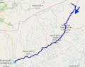
 Bouregreg.png 751 × 636; 419 KB
-
 Dadès OSM.png 476 × 373; 128 KB
-
 Daoura OSM.png 1,577 × 2,243; 5.46 MB
-
-
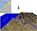
 Karte Unfallort der Yacht 'Taube'.png 945 × 643; 295 KB
-
 Moulouya River Bassin OSM.png 2,992 × 2,621; 13.65 MB
-
 Moulouya.png 775 × 600; 800 KB
-
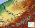 Oum Er-Rbia River Basin OSM.png 2,243 × 1,787; 7.17 MB
-
 Oum Er-Rbia River.svg 1,223 × 995; 284 KB
-
 Oum Errabiâ.png 1,218 × 657; 1,000 KB
-
 Rivers between Casablanka and Rabat OSM.png 1,402 × 1,093; 2.5 MB
-
 Rivers of North - West Morocco OSM.png 1,769 × 1,226; 2.88 MB
-
 Rivers of north Morocco OSM.svg 5,613 × 4,681; 73.53 MB
-
 Saoura OSM.png 2,278 × 3,294; 10.62 MB
-
 Sebou Bassin OSM.png 2,032 × 1,927; 7.19 MB
-
 Sebou River.svg 1,223 × 995; 284 KB
-
 Tafna Bassin OSM.png 1,370 × 1,111; 2.22 MB
-
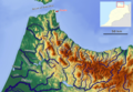
 Tensift Basin OSM.png 1,682 × 1,051; 2.77 MB
-
 Upper Draa OSM.png 1,594 × 1,489; 4.64 MB
-
 Upper Draa.png 424 × 400; 19 KB
-
 خريطة الرباط سلا 1942.jpg 4,378 × 5,966; 7.76 MB


