Category:Maps of rivers of Guinea-Bissau
Jump to navigation
Jump to search
Countries of Africa: Algeria · Angola · Benin · Burkina Faso · Burundi · Central African Republic · Chad · Democratic Republic of the Congo · Republic of the Congo · Equatorial Guinea · Ethiopia · Gabon · Ghana · Guinea · Guinea-Bissau · Ivory Coast · Kenya · Lesotho · Madagascar · Mali · Morocco · Mozambique · Namibia · Niger · Nigeria · Rwanda · Senegal · South Africa · South Sudan · Sudan · Togo · Tunisia · Uganda · Zambia · Zimbabwe
Media in category "Maps of rivers of Guinea-Bissau"
The following 8 files are in this category, out of 8 total.
-
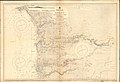
 Admiralty Chart No 1722 Cacheo River, Published 1845, Revisons to 1899. (composite).jpg 19,928 × 8,761; 19.57 MB
-
 Admiralty Chart No 1722 Cacheo River, Published 1845, Revisons to 1899.jpg 10,983 × 8,059; 27.44 MB
-
 Admiralty Chart No 1722 Entrance to the Rio Cacheu, Published 1958.jpg 16,360 × 11,065; 27.46 MB
-
 Admiralty Chart No 3253 Rio Cacheu, Published 1959.jpg 11,213 × 8,233; 19.24 MB
-
 Admiralty Chart No 599 Cape Verde to River Cacheo, Published 1896.jpg 16,415 × 11,285; 45.86 MB
-
 Admiralty Chart No 600 Cacheo River to Iles de Los, Published 1899.jpg 16,300 × 11,092; 55.13 MB
-
 Geba Corubal OSM.png 3,319 × 1,769; 8.09 MB
-
 Guinea Bisau OSM.png 3,311 × 1,752; 8.45 MB
.jpg)


