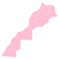
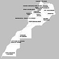
Category:Maps of regions of Morocco
Appearance
Countries of Africa: Burkina Faso · Cameroon · Chad · Djibouti · Egypt‡ · Equatorial Guinea · Ethiopia · Guinea · Ivory Coast · Libya · Madagascar · Malawi · Mali · Mauritania · Morocco · Namibia · Niger · Senegal · Somalia · South Sudan · Sudan · Tanzania · Togo · Uganda
Limited recognition: Ambazonia · Somaliland
‡: partly located in Africa
Limited recognition: Ambazonia · Somaliland
‡: partly located in Africa
Subcategories
This category has the following 15 subcategories, out of 15 total.
B
- Maps of Béni Mellal-Khénifra (13 F)
C
D
- Maps of Dakhla-Oued Ed Dahab (22 F)
- Maps of Drâa-Tafilalet (14 F)
F
G
- Maps of Guelmim-Oued Noun (16 F)
L
M
O
R
- Maps of Rabat-Salé-Kénitra (19 F)
S
- Maps of Souss-Massa (23 F)
T
Media in category "Maps of regions of Morocco"
The following 49 files are in this category, out of 49 total.
-
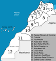
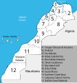
12 régions du Maroc.png 780 × 859; 115 KB
-
Administrative Regions of Morocco.jpg 1,963 × 2,197; 423 KB
-
Carte régional des ressources en eau .jpg 868 × 659; 159 KB
-
Carte-region-maroc.jpg 466 × 454; 49 KB
-
Espace linguistique du Jebli au nord du Maroc.PNG 477 × 341; 3 KB
-
Fig-2-Map-of-Morocco-illustrating-the-16-administrative-regions.gif 778 × 652; 127 KB
-
Guelminessemara.png 370 × 372; 25 KB
-
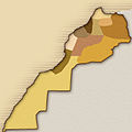
Historical regions of Morocco.jpg 168 × 168; 19 KB
-
Khenifra map 1953.JPG 753 × 658; 164 KB
-
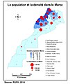
La population et la densité par les region Marocaine.jpg 2,481 × 2,945; 863 KB
-
Map of the regions of Morocco.png 3,183 × 3,343; 382 KB
-
Map Region Morocco.jpg 1,156 × 1,166; 359 KB
-
Mapa MARROCOS-2015-REGIÕES-.png 1,392 × 1,114; 45 KB
-
Mapa MARROCOS-2015-REGIÕES-I-.png 1,924 × 1,940; 68 KB
-
Marokko-regions-nr.png 370 × 372; 30 KB
-
Maroko administativni-deleni.png 371 × 371; 38 KB
-
Maroko+Zapadni-Sahara administativni-deleni.png 371 × 371; 44 KB
-
Moroccan regions, provinces and prefectures, Province Tarfaya.png 590 × 568; 15 KB
-
Moroccan Regions.svg 675 × 704; 104 KB
-
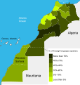
Morocco and Western Sahara Regions Amazigh Languages Speakers-es.svg 596 × 629; 54 KB
-
Morocco Base Map.png 1,108 × 691; 281 KB
-
Morocco including western sahara.png 590 × 568; 20 KB
-
Morocco map.png 590 × 568; 20 KB
-
Morocco Regions 2011 Proposition1 Numbered Reel1.png 800 × 802; 143 KB
-
Morocco Regions 2011 Proposition1 Numbered Rel1.svg 1,021 × 1,023; 355 KB
-
Morocco Regions 2011 Proposition2 Midelt Rel1.svg 1,021 × 1,023; 354 KB
-
Morocco Regions 2011 Proposition2 real.png 598 × 599; 97 KB
-
Morocco Regions 2011 Proposition3 Figuig.svg 1,021 × 1,023; 351 KB
-
Morocco Regions 2011 Proposition3 real.png 800 × 802; 143 KB
-
Morocco Regions 2015 numbered.svg 610 × 655; 191 KB
-
Morocco Regions 2015.png 610 × 655; 107 KB
-
Morocco Regions 97-11 numbered.svg 596 × 629; 411 KB
-
Morocco regions Amazigh languages speakers.svg 596 × 629; 191 KB
-
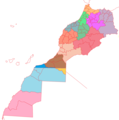
Morocco regions, blank.png 655 × 555; 21 KB
-
Morocco Regions.svg 744 × 1,052; 94 KB
-
Morocco-Regions-2015-Darija.png 1,256 × 1,037; 226 KB
-
Percentage of Arabic speakers in Morocco.png 2,483 × 1,185; 114 KB
-
Region tanger partis 2015.svg 900 × 675; 26 KB
-
Regional map of Morocco - 1971.svg 879 × 920; 190 KB
-
Regional map of Morocco - post 2015.svg 879 × 920; 213 KB
-
Regions du Maroc (1).png 374 × 379; 17 KB
-
Regions du Maroc.svg 1,282 × 1,299; 99 KB
-
Regions of Morocco (blank).svg 744 × 1,052; 39 KB
-
Regions of Morocco (post 2015).svg 744 × 1,052; 94 KB
-
Regions of Morocco 2015.svg 5,975 × 6,060; 614 KB
-
Regions of Morocco.svg 623 × 610; 43 KB
-
REGMAROC.jpg 707 × 709; 38 KB
-
Tasgiwin n Murakuc - Regions of Morocco.png 1,912 × 1,939; 656 KB
-
جهات المغرب1971.png 612 × 385; 25 KB

