Category:Maps of regions of Burkina Faso
Jump to navigation
Jump to search
Countries of Africa: Burkina Faso · Cameroon · Chad · Djibouti · Egypt‡ · Equatorial Guinea · Ethiopia · Guinea · Ivory Coast · Libya · Madagascar · Malawi · Mali · Mauritania · Morocco · Namibia · Niger · Senegal · Somalia · South Sudan · Sudan · Tanzania · Togo · Uganda
Limited recognition: Ambazonia · Somaliland
‡: partly located in Africa
Limited recognition: Ambazonia · Somaliland
‡: partly located in Africa
| NO WIKIDATA ID FOUND! Search for Maps of regions of Burkina Faso on Wikidata | |
| Upload media |
Subcategories
This category has the following 2 subcategories, out of 2 total.
*
L
Media in category "Maps of regions of Burkina Faso"
The following 4 files are in this category, out of 4 total.
-
 BurkinaFaso Regions.png 613 × 441; 10 KB
-
 Burkina Faso regions named.png 750 × 549; 31 KB
-
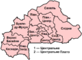
 Burkina Faso Regions (ru).png 750 × 549; 75 KB
-
 Burkina Faso Regions (ua).png 750 × 549; 87 KB


.png)
.png)