Category:Maps of provinces of South Africa
Appearance
Subcategories
This category has the following 13 subcategories, out of 13 total.
E
F
G
K
L
M
N
W
Media in category "Maps of provinces of South Africa"
The following 51 files are in this category, out of 51 total.
-
Base Map of South Africa.png 1,102 × 700; 360 KB
-
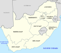
Kaart van Suid-Afrika met Afrikaanse byskrifte.svg 757 × 660; 352 KB
-
Majimbo Afrika Kusini.jpg 1,026 × 899; 153 KB
-
Map of South Africa with Belarusian labels.svg 1,071 × 934; 335 KB
-
Map of South Africa with English labels.svg 809 × 709; 540 KB
-
Map of South Africa with ISO 3166 codes.svg 809 × 709; 464 KB
-
Map of South Africa with official provincial borders 1981-1994.svg 809 × 709; 415 KB
-
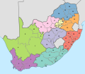
Map of South Africa with provinces shaded and districts numbered (2009).svg 809 × 709; 1.22 MB
-
Map of South Africa with provinces shaded and districts numbered (2016).svg 809 × 709; 1.19 MB
-
Map of South Africa with provincial borders 1910-1976.svg 809 × 709; 392 KB
-
Map of South Africa with provincial borders 1976-1994.svg 809 × 709; 389 KB
-
Map of South Africa with provincial borders 1994-2006.png 2,000 × 1,749; 193 KB
-
Map of South Africa with provincial borders.svg 809 × 709; 462 KB
-
Map of South Africa with Serbian labels.svg 1,071 × 934; 285 KB
-
Map of South Africa with Spanish labels.png 800 × 615; 360 KB
-
Map of South Africa-ar.svg 1,000 × 1,000; 287 KB
-
Map of South Africa.svg 1,000 × 1,000; 475 KB
-
Map of the administrative geography of South Africa 2018.svg 3,179 × 2,245; 2.21 MB
-
Map of the administrative geography of South Africa 2021.svg 3,179 × 2,245; 1.63 MB
-
Map of the administrative geography of South Africa 2024.svg 3,179 × 2,245; 1.63 MB
-
Map of the provinces of South Africa 1910-1976 with English labels.svg 809 × 709; 393 KB
-
Map of the provinces of South Africa 1976-1994 with English labels.svg 809 × 709; 390 KB
-
Mapa de Sudáfrica con etiquetas en español.svg 1,071 × 934; 286 KB
-
Province of South West Africa in the Union of South Africa.png 532 × 516; 14 KB
-
Provinces of South Africa-nso.svg 1,071 × 934; 282 KB
-
Provinces of South Africa-SS.svg 1,071 × 934; 286 KB
-
Provinces of South Africa-st.svg 1,071 × 934; 283 KB
-
Provinces of South Africa-ve.svg 1,071 × 934; 286 KB
-
Provinces of South Africa-xh.svg 1,071 × 934; 283 KB
-
Provinces of South Africa-ZU.svg 1,071 × 934; 286 KB
-
Provincial Map of South Africa.svg 1,000 × 1,000; 204 KB
-
Províncias da África do Sul.svg 1,071 × 934; 287 KB
-
Províncies actuals de Sud-àfrica.svg 500 × 438; 64 KB
-
SA provinces.svg 1,000 × 771; 134 KB
-
South Africa 1991.jpg 818 × 635; 199 KB
-
South Africa 2006 provincial border changes map.svg 1,123 × 982; 591 KB
-
South Africa blank map.svg 836 × 709; 25 KB
-
South Africa Districts April 2006 2 zh.png 350 × 254; 26 KB
-
South Africa Election 1974.png 1,026 × 899; 92 KB
-
South Africa provinces + flag back.png 766 × 582; 38 KB
-
South Africa Provinces labeled.svg 1,146 × 828; 45 KB
-
South Africa Provinces showing nuclear sites.PNG 1,146 × 828; 21 KB
-
South Africa Provinces.png 1,146 × 828; 20 KB
-
South African election 1966.png 1,026 × 899; 90 KB
-
SouthAfricaNumbered (transparent).png 400 × 350; 44 KB
-
SouthAfricaNumbered.png 400 × 350; 30 KB
-
Sudafrica politica.svg 200 × 175; 37 KB
-
南非省份地图 (1910年-1976年).gif 1,024 × 897; 42 KB


