Category:Maps of KwaZulu-Natal
Jump to navigation
Jump to search
Provinces of South Africa: Eastern Cape · Free State · Gauteng · KwaZulu-Natal · Limpopo · Mpumalanga · Northern Cape · North West · Western Cape
Wikimedia category | |||||
| Upload media | |||||
| Instance of | |||||
|---|---|---|---|---|---|
| Category combines topics | |||||
| KwaZulu-Natal | |||||
province of South Africa | |||||
| Instance of | |||||
| Location | RSA | ||||
| Capital | |||||
| Legislative body | |||||
| Executive body |
| ||||
| Head of government |
| ||||
| Inception |
| ||||
| Highest point |
| ||||
| Population |
| ||||
| Area |
| ||||
| Elevation above sea level |
| ||||
| Replaces | |||||
| official website | |||||
 | |||||
Subcategories
This category has the following 5 subcategories, out of 5 total.
Media in category "Maps of KwaZulu-Natal"
The following 51 files are in this category, out of 51 total.
-
Admiralty Chart No 2087 Port St John's To Durban, Published 1960.jpg 11,060 × 16,245; 59.85 MB
-
Admiralty Chart No 3300 Bashee Point to Lourenco Marques, Published 1963.jpg 11,298 × 16,435; 20.59 MB
-
Admiralty Chart No 3794 Port St Johns to Port Shepstone, Published 1929.jpg 11,077 × 16,191; 35.11 MB
-
Admiralty Chart No 3795 Port Shepstone to Durban, Published 1929.jpg 11,062 × 16,199; 37.92 MB
-
Admiralty Chart No 3795 Port Shepstone to Durban, Published 1960.jpg 11,243 × 16,422; 34.67 MB
-
Admiralty Chart No 3796 Durban to Tugela River, Published 1930.jpg 16,370 × 11,231; 34.97 MB
-
Blank map of KwaZulu-Natal (2006).svg 663 × 754; 2.17 MB
-
Blank map of KwaZulu-Natal (2011).svg 663 × 754; 484 KB
-
Blank map of KwaZulu-Natal (2016).svg 663 × 754; 640 KB
-
JCW-Map-Natal-Baba.png 300 × 317; 11 KB
-
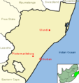
JCW-Map-Natal-Durban.png 298 × 315; 10 KB
-
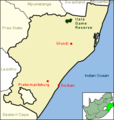
JCW-Map-Natal-Itala.png 300 × 317; 11 KB
-
JCW-Map-Natal-Lady.png 300 × 317; 11 KB
-
JCW-Map-Natal-Newcastle.png 300 × 317; 11 KB
-
JCW-Map-Natal-Nongoma.png 300 × 317; 11 KB
-
JCW-Map-Natal-Pmb.png 300 × 317; 10 KB
-
JCW-Map-Natal-StLucia.png 300 × 317; 11 KB
-
JCW-Map-Natal-Tugela.png 300 × 317; 279 KB
-
JCW-Map-Natal-Utrecht.png 300 × 317; 11 KB
-
Karte der Neuen Republik.jpg 2,526 × 2,242; 2.24 MB
-
KwaZulu-Natal 2001 dominant language map.svg 938 × 1,066; 1.06 MB
-
KwaZulu-Natal 2001 dominant population group map.svg 938 × 1,066; 995 KB
-
KwaZulu-Natal 2001 population density map.svg 938 × 1,066; 3.54 MB
-
KwaZulu-Natal 2011 population density map.svg 938 × 1,066; 2.38 MB
-
KwaZulu-Natal regions map.png 4,688 × 3,906; 1.86 MB
-
KwaZulu-Natal regions map.svg 750 × 625; 1.7 MB
-
KwaZulu.gif 266 × 268; 13 KB
-
Map of definitions of Zululand-KwaZulu.svg 1,024 × 1,242; 4.26 MB
-
Map of KwaZulu Natal2008.pdf 1,420 × 1,785; 1.25 MB
-
Map of KwaZulu-Natal with municipalities blank (2006).svg 712 × 805; 1.84 MB
-
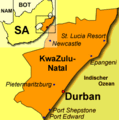
Map-South Africa-KwaZulu Natal.svg 744 × 1,052; 377 KB
-
Map-South Africa-KwaZulu Natal02.png 1,032 × 1,085; 302 KB
-
Natal province - descriptive guide and official hand-book (1911) (14573852068).jpg 3,338 × 3,444; 823 KB
-
Natal province - descriptive guide and official hand-book (1911) (14574073508).jpg 4,016 × 2,760; 1.8 MB
-
South Africa KwaZulu-Natal location map.svg 1,000 × 1,140; 244 KB
-
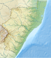
South Africa KwaZulu-Natal relief location map.svg 1,000 × 1,140; 2.28 MB
-
Tugela.png 300 × 317; 31 KB
-
ZA-KZN-battlef.png 398 × 398; 57 KB
-
ZA-KZN-drak.png 398 × 398; 58 KB
-
ZA-KZN-egriq.png 398 × 398; 58 KB
-
ZA-KZN-elefc.png 398 × 398; 58 KB
-
ZA-KZN-grdurb.png 398 × 398; 58 KB
-
ZA-KZN-map.png 398 × 398; 58 KB
-
ZA-KZN-map.svg 398 × 398; 43 KB
-
ZA-KZN-midl.png 398 × 398; 57 KB
-
ZA-KZN-northc.png 398 × 398; 58 KB
-
ZA-KZN-southc.png 398 × 398; 58 KB
-
ZA-KZN-zulu.png 398 × 398; 57 KB


