Category:Maps of provinces in Kenya
Jump to navigation
Jump to search
Subcategories
This category has the following 8 subcategories, out of 8 total.
Media in category "Maps of provinces in Kenya"
The following 10 files are in this category, out of 10 total.
-
 Kenya Provinces numbered.svg 435 × 524; 26 KB
-
 Kenya Provinces numbered mk.svg 435 × 524; 37 KB
-
 Kenya Provinces numbered 300px.png 300 × 348; 28 KB
-
 Kenya Base Map.png 1,104 × 702; 397 KB
-
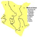 Kenya mikoa.JPG 573 × 571; 33 KB
-
 Kenya mikoa.png 573 × 571; 35 KB
-
 Kenya provinces.png 1,601 × 1,027; 20 KB
-
 Kenya Provinces1.png 300 × 348; 26 KB
-
 Kenya-provinces.svg 720 × 720; 192 KB
-
 Kenyas provinser.png 977 × 1,171; 132 KB


