Category:Maps of Western Province (Kenya)
Jump to navigation
Jump to search
Media in category "Maps of Western Province (Kenya)"
The following 15 files are in this category, out of 15 total.
-
 Kakamega forest map.jpg 498 × 512; 56 KB
-
 KE-Busia.png 488 × 572; 8 KB
-
 KE-Webuye.png 488 × 572; 7 KB
-
 Kenya Provinces Western.png 300 × 348; 25 KB
-
 Kenya Provinces Western.svg 300 × 348; 23 KB
-
 Kenya westp.jpg 225 × 225; 8 KB
-
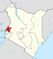
 Kenya-Western.png 488 × 572; 7 KB
-
 Province occidentale.png 455 × 699; 204 KB
-
 Rift Valley-Western location map.png 247 × 485; 8 KB
-
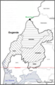
 Western Counties - bungoma.png 455 × 699; 197 KB
-
 Western counties - Busia.png 455 × 699; 200 KB
-
 Western Counties - Kakamega.png 455 × 699; 198 KB
-
 Western counties - Vihiga.png 455 × 699; 204 KB
-
 Western in Kenya (+Ilemi Triangle).svg 1,000 × 1,100; 305 KB
-
 Western in Kenya.svg 1,000 × 1,100; 304 KB


.svg)
