Category:Maps of municipalities of Anzoátegui
Jump to navigation
Jump to search
Federal territory: Capital District ·
Subcategories
This category has only the following subcategory.
Media in category "Maps of municipalities of Anzoátegui"
The following 7 files are in this category, out of 7 total.
-
 Anzoategui.PNG 480 × 366; 10 KB
-
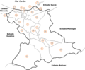 Municipios estado anzoategui.png 763 × 627; 24 KB
-
 Elecciones Gobernador Anzoátegui 2008.svg 628 × 343; 65 KB
-
 Mapa físico del término municipal de Málaga..png 1,502 × 1,127; 1.85 MB
-
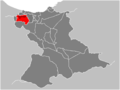
 Simonrodriguez-anzoategui-mapag.jpg 500 × 347; 37 KB
-
 Ubicación de Guanape en el estado Anzoátegui.png 1,506 × 1,130; 356 KB
-
 Venezuela Anzoátegui location map (adm colored).svg 2,020 × 1,720; 637 KB


.svg)