Category:Maps of municipalities of Táchira
Jump to navigation
Jump to search
Subcategories
This category has only the following subcategory.
Media in category "Maps of municipalities of Táchira"
The following 8 files are in this category, out of 8 total.
-
 LocMun VE-S.png 1,446 × 1,610; 51 KB
-
 MAP-S-Densidad de Poblacion - Parroquias.svg 800 × 892; 2.55 MB
-
 Mapa Municipio Sucre.png 800 × 1,132; 66 KB
-
 TACHIRAmunicipios.svg 510 × 550; 120 KB
-
 VE-S-Regiones.png 1,479 × 1,639; 305 KB
-
 VE-S-Transp.png 1,479 × 1,639; 371 KB
-
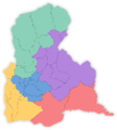
 Venezuela Táchira location map (adm colored).svg 729 × 817; 567 KB
-
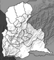 Venezuela Táchira locator map.png 738 × 820; 375 KB


.svg)
