Category:Maps of municipalities in the district of Kreuzlingen
Jump to navigation
Jump to search
Subcategories
This category has the following 10 subcategories, out of 10 total.
1
Media in category "Maps of municipalities in the district of Kreuzlingen"
The following 15 files are in this category, out of 15 total.
-
 Karte Gemeinden des Bezirks Kreuzlingen 2011.png 1,476 × 1,009; 331 KB
-
 Karte Gemeinde Altnau 2011.png 1,476 × 1,009; 331 KB
-
 Karte Gemeinde Bottighofen 2011.png 1,476 × 1,009; 331 KB
-
 Karte Gemeinde Ermatingen 2011.png 1,476 × 1,009; 331 KB
-
 Karte Gemeinde Gottlieben 2011.png 1,476 × 1,009; 331 KB
-
 Karte Gemeinde Güttingen 2011.png 1,476 × 1,009; 331 KB
-
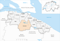 Karte Gemeinde Kemmental 2011.png 1,476 × 1,009; 332 KB
-
 Karte Gemeinde Kreuzlingen 2011.png 1,476 × 1,009; 331 KB
-
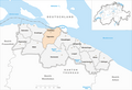
 Karte Gemeinde Langrickenbach 2011.png 1,476 × 1,009; 332 KB
-
 Karte Gemeinde Lengwil 2011.png 1,476 × 1,009; 332 KB
-
 Karte Gemeinde Münsterlingen 2011.png 1,476 × 1,009; 332 KB
-
 Karte Gemeinde Raperswilen 2011.png 1,476 × 1,009; 331 KB
-
 Karte Gemeinde Salenstein 2011.png 1,476 × 1,009; 331 KB
-
 Karte Gemeinde Tägerwilen 2011.png 1,476 × 1,009; 331 KB
-
 Karte Gemeinde Wäldi 2011.png 1,476 × 1,009; 331 KB


