Category:Maps of municipalities in Puerto Rico
Jump to navigation
Jump to search
Subcategories
This category has the following 80 subcategories, out of 80 total.
A
B
C
D
F
G
H
I
J
L
M
N
O
P
Q
R
S
T
U
V
Y
Media in category "Maps of municipalities in Puerto Rico"
The following 13 files are in this category, out of 13 total.
-
-
-
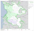
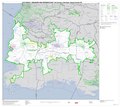
 Geographic Areas Reference Manual Figure 7-8.png 945 × 759; 377 KB
-
 Locator-map-Puerto-Rico.svg 1,332 × 360; 38 KB
-
 Map of the 78 municipalities of Puerto Rico.png 2,337 × 1,053; 93 KB
-
 Municipia Portorici.png 2,116 × 648; 509 KB
-
 Municipios pr.svg 1,300 × 550; 199 KB
-
 Municipios puertorico.svg 1,300 × 550; 194 KB
-
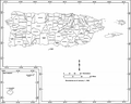
 PR Municipalities.JPG 2,315 × 509; 143 KB
-
 PR Municipalities.png 1,938 × 509; 582 KB
-
 Puerto Rico municipality map, cb 500k.svg 744 × 262; 272 KB
-
 Puerto Rico municipios locator map.svg 1,332 × 360; 97 KB
-
 USA Puerto Rico labeled.svg 1,058 × 325; 171 KB


