Category:Maps of Vieques, Puerto Rico
Jump to navigation
Jump to search
Wikimedia category | |||||
| Upload media | |||||
| Instance of | |||||
|---|---|---|---|---|---|
| Category combines topics | |||||
| Vieques | |||||
island-municipality in Puerto Rico  Pohled ze vzduchu    | |||||
| Instance of | |||||
| Part of |
| ||||
| Location | Puerto Rico, Caribbean | ||||
| Located in or next to body of water | |||||
| Capital |
| ||||
| Heritage designation | |||||
| Inception |
| ||||
| Width |
| ||||
| Length |
| ||||
| Population |
| ||||
| Area |
| ||||
| Elevation above sea level |
| ||||
| Said to be the same as | Vieques | ||||
 | |||||
Subcategories
This category has only the following subcategory.
L
Media in category "Maps of Vieques, Puerto Rico"
The following 20 files are in this category, out of 20 total.
-

-
 Florida Barrio.gif 575 × 425; 31 KB
-
 Isabel II barrio-pueblo.gif 575 × 425; 30 KB
-
 Llave barrio.gif 575 × 425; 26 KB
-
 Map of Vieques in Belarusian.svg 800 × 303; 65 KB
-
 Maps in the Puerto Rico 2010 Census of Population and Housing Page 127.jpg 2,200 × 1,700; 288 KB
-
 Mosquito barrio.gif 575 × 425; 28 KB
-
 NOAA chart 25664 1976.png 1,133 × 888; 1.47 MB
-
 Puerto Diablo barrio.gif 575 × 425; 23 KB
-
 Puerto Ferro barrio.gif 575 × 425; 33 KB
-
 Puerto Real barrio.gif 575 × 425; 38 KB
-
 Punta Arenas barrio.gif 575 × 425; 18 KB
-
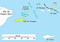 Spanish-virgin-islands.jpg 648 × 453; 30 KB
-
 Topographic map of the Island of Vieques, Puerto Rico 1951.jpg 14,096 × 5,376; 47.59 MB
-
 Topographic map of the Island of Vieques, Puerto Rico LOC 2004628534.tif 14,860 × 12,580; 534.84 MB
-
 Topographic map of the Island of Vieques, Puerto Rico LOC 88693720.jpg 14,096 × 5,376; 13.23 MB
-
 Topographic map of the Island of Vieques, Puerto Rico LOC 88693720.tif 14,096 × 5,376; 216.81 MB
-
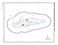
 Vieques Barrios.jpg 14,096 × 5,376; 18.42 MB
-
 Vieques Map Shape.png 1,132 × 1,118; 272 KB
-
 Vieques-empty.png 800 × 303; 34 KB
.jpg)


