Category:Maps of metropolitan areas in the United Kingdom
Jump to navigation
Jump to search
Subcategories
This category has only the following subcategory.
Media in category "Maps of metropolitan areas in the United Kingdom"
The following 23 files are in this category, out of 23 total.
-
 AccringtonRossendaleBUA2011.png 1,116 × 850; 1,014 KB
-
 BCPBUA.png 1,618 × 850; 1.41 MB
-
 BlackpoolBUA.png 413 × 850; 422 KB
-
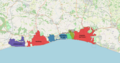 BrightonAndHoveBUA.png 1,618 × 850; 1.15 MB
-
 BurnleyBUA2011.png 1,101 × 816; 827 KB
-
 CannockGreatWyrley.png 664 × 850; 715 KB
-
 Chepping Wycombe Urban Area.png 781 × 850; 873 KB
-
 FarnAldershot.png 989 × 817; 133 KB
-
 Geographic footprint of RUCLAD classification England.jpg 1,078 × 1,215; 455 KB
-
 Greater bristol with everything.png 720 × 566; 139 KB
-
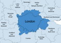
 GreaterLondonBUA2011.png 1,066 × 850; 1.94 MB
-
 Liverpool-Manchester Combined Urban Area.png 435 × 267; 121 KB
-
 020 UK dial code area - 2007.png 561 × 439; 460 KB
-
 London TTWA 2001.png 1,648 × 1,171; 121 KB
-
 LutonDunstableBUA.png 1,618 × 850; 92 KB
-
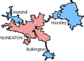 NuneatonUrbanArea.svg 455 × 328; 23 KB
-
 PotteriesBUA.png 745 × 850; 867 KB
-
 SouthendOnSeaBUA.png 1,618 × 850; 1.48 MB
-
 United Kingdom Settlement Points (6172877244).jpg 2,324 × 3,188; 858 KB
-
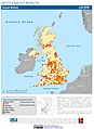
 United Kingdom Urban Extents (6172034889).jpg 2,336 × 3,189; 790 KB
-
 WarwickLeamingtonSpaBUA2011.png 1,079 × 850; 1.09 MB
-
 WearsideBUA.png 850 × 850; 1 MB
-
 WestYorkshireUrbanArea.svg 1,176 × 1,232; 208 KB


.jpg)
.jpg)


