Category:Maps of metropolitan areas
Jump to navigation
Jump to search
Subcategories
This category has the following 33 subcategories, out of 33 total.
A
B
C
G
I
J
L
M
P
S
U
V
Media in category "Maps of metropolitan areas"
The following 15 files are in this category, out of 15 total.
-
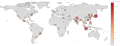
 2006megacities-1-.png 1,425 × 625; 64 KB
-
 Areametrope.svg 1,000 × 919; 2.49 MB
-
 Aurora dmsp.jpg 880 × 880; 463 KB
-
 Carte représentant l'Archipel Mégalopolitian Mondial.jpg 821 × 501; 47 KB
-
 Haifa metropolis.gif 2,048 × 2,649; 115 KB
-
 HCMC metropolitan area outline.png 740 × 908; 36 KB
-
 Map of Prague metropolitan area.png 1,017 × 1,017; 213 KB
-
 Metropolitan areas.svg 1,300 × 500; 690 KB
-
 Metropolregionen.svg 1,300 × 500; 690 KB
-
 Sharjah Districts.png 1,200 × 983; 492 KB
-
 Suur-Tallinn.jpg 1,846 × 1,422; 566 KB
-
 TelAviv LightRail AllLines 2012.svg 3,384 × 5,736; 51 KB
-
 Urbanization Rate by Pakistani Division.svg 3,200 × 2,000; 1.18 MB
-
 Wellington Urban Area.png 1,003 × 897; 129 KB
-
 Áreas urbanizadas en España.jpg 1,708 × 1,267; 529 KB


