Category:Maps of islands of Alaska
Jump to navigation
Jump to search
Subcategories
This category has the following 8 subcategories, out of 8 total.
A
- Maps of the Aleutian Islands (77 F)
- Maps of Augustine Island (3 F)
K
N
- Maps of Nunivak Island (9 F)
P
- Maps of the Pribilof Islands (21 F)
S
- Maps of Saint Matthew Island (4 F)
Media in category "Maps of islands of Alaska"
The following 8 files are in this category, out of 8 total.
-
 Cordova1..PNG 689 × 455; 718 KB
-

-

-

-
 FMIB 40792 Sketch of Kunk Lake and Stream, Etolin Island, Alaska.jpeg 1,090 × 1,042; 206 KB
-
 Map of Punuk Islands.png 1,200 × 800; 68 KB
-
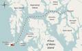 MapStarOfBengalCrash.png 1,246 × 774; 373 KB
-
 St. Paul Island (26552812306).jpg 3,469 × 2,312; 3.74 MB


.jpg)