Category:Maps of freguesias of Porto
Jump to navigation
Jump to search
English: Oporto civil parish maps
Português: Mapas de freguesias do Porto
Media in category "Maps of freguesias of Porto"
The following 24 files are in this category, out of 24 total.
-
 Aldoar, Foz do Douro e Nevogilde no Porto.png 1,200 × 649; 90 KB
-
 Bonfim no Porto.png 1,200 × 649; 89 KB
-
 Campanhã no Porto.png 1,200 × 649; 90 KB
-
 Cedofeita, Santo Ildefonso, Sé, Miragaia, São Nicolau e Vitória no Porto.png 1,200 × 649; 89 KB
-
 Freguesias jl.jpg 1,432 × 751; 486 KB
-
 LocalFregPorto-Aldoar.svg 1,000 × 500; 82 KB
-
 LocalFregPorto-Bonfim.svg 1,000 × 500; 82 KB
-
 LocalFregPorto-Campanhã.svg 1,000 × 500; 82 KB
-
 LocalFregPorto-Cedofeita.svg 1,000 × 500; 82 KB
-
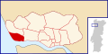 LocalFregPorto-FozDoDouro.svg 1,000 × 500; 82 KB
-
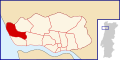
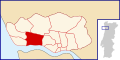 LocalFregPorto-LordeloDoOuro.svg 1,000 × 500; 82 KB
-
 LocalFregPorto-Massarelos.svg 1,000 × 500; 82 KB
-
 LocalFregPorto-Miragaia.svg 1,000 × 500; 82 KB
-
 LocalFregPorto-Nevogilde.svg 1,000 × 500; 82 KB
-
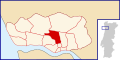
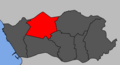
 LocalFregPorto-Paranhos.svg 1,000 × 500; 82 KB
-
 LocalFregPorto-Ramalde.svg 1,000 × 500; 82 KB
-
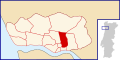 LocalFregPorto-SantoIldefonso.svg 1,000 × 500; 82 KB
-
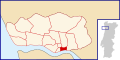
 LocalFregPorto-SãoNicolau.svg 1,000 × 500; 82 KB
-
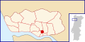
 LocalFregPorto-Sé.svg 1,000 × 500; 82 KB
-
 LocalFregPorto-Vitória.svg 1,000 × 500; 82 KB
-
 Lordelo do Ouro e Massarelos no Porto.png 1,200 × 649; 89 KB
-
 Paranhos no Porto.png 1,200 × 649; 90 KB
-
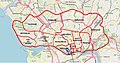
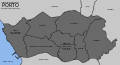 Porto freguesias 2013.svg 1,850 × 1,000; 217 KB
-
 Ramalde no Porto.png 1,200 × 649; 90 KB


