Category:Maps of Porto
Jump to navigation
Jump to search
English: Maps of Oporto
Português: Mapas do Porto
Wikimedia category | |||||
| Upload media | |||||
| Instance of | |||||
|---|---|---|---|---|---|
| Category combines topics | |||||
| Porto | |||||
municipality and city in Portugal | |||||
| Pronunciation audio | |||||
| Instance of | |||||
| Location | |||||
| Located in or next to body of water | |||||
| Executive body | |||||
| Head of government | |||||
| Significant event |
| ||||
| Population |
| ||||
| Area |
| ||||
| Elevation above sea level |
| ||||
| Different from | |||||
| official website | |||||
 | |||||
Subcategories
This category has the following 4 subcategories, out of 4 total.
Media in category "Maps of Porto"
The following 31 files are in this category, out of 31 total.
-
Baixa Downtown Porto.jpg 1,174 × 678; 260 KB
-
Batalha do Porto - 29Mar1809.jpg 1,525 × 1,208; 576 KB
-
Cultural heritage - national heritage.jpg 1,101 × 711; 260 KB
-
FOZ Captura de ecrã 2024-10-10 152617.jpg 1,026 × 576; 166 KB
-
Freguesiae Portus Calis anno 2013.PNG 1,920 × 1,038; 379 KB
-
Historic Centre of Oporto.jpg 1,022 × 741; 293 KB
-
Historical Zone of Oporto.jpg 1,350 × 808; 369 KB
-
Imóveis com Interesse Patrimonial no Porto.png 1,215 × 748; 1.42 MB
-
Kreis Porto 2020.png 2,500 × 2,033; 791 KB
-
LocalPorto.svg 250 × 366; 614 KB
-
Map of Porto.jpg 2,229 × 1,755; 1.13 MB
-
Mapa da Batalha do Douro (12 de Maio de 1809).jpg 825 × 572; 597 KB
-
Mapa-final.pdf 1,239 × 1,752; 597 KB
-
Maps of Porto.jpg 1,755 × 1,148; 617 KB
-
Morro da Sé.jpg 685 × 610; 148 KB
-
Morro da Vitória.jpg 529 × 503; 96 KB
-
Muralha Primitiva (Porto).svg 744 × 1,052; 30 KB
-
Muralhas Fernandinas.svg 2,718 × 2,512; 123 KB
-
OPO - 20160421 - 11 (25999538284).jpg 1,600 × 1,067; 1,006 KB
-
Passeio maritimo 2.jpg 799 × 756; 152 KB
-
Planta topográfica da cidade do Porto; quadrícula 300.jpg 5,304 × 3,549; 1.84 MB
-
Porto Foz de Douro Map.svg 3,293 × 1,836; 14.04 MB
-
Porto OpenStreetMap.png 1,946 × 1,501; 2.01 MB
-
Reserva Natural Local do Estuário do Douro.jpg 1,330 × 883; 226 KB
-
Ribeira (Porto).jpg 1,104 × 652; 166 KB
-
Sinaletica Metro (Porto).jpg 800 × 600; 100 KB
-
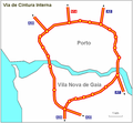
VCI.PNG 683 × 632; 36 KB
-
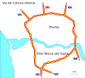
VCI.svg 683 × 633; 39 KB
-
Vias romanas (Porto).svg 431 × 536; 34 KB
-
Views from Terreiro da Se.png 1,146 × 988; 650 KB
-
Zona da Foz (Porto).jpg 1,014 × 717; 311 KB


