Category:Maps of former districts of Taichung
Jump to navigation
Jump to search
English: This category is only suitable for during the provincial city(1947-2010).
日本語: このカテゴリは省轄市(1974-2010)にのみ適用されます。
中文(臺灣):這個類別只適用於省轄市期間(1974-2010)。
Media in category "Maps of former districts of Taichung"
The following 16 files are in this category, out of 16 total.
-
 Taityu hokuku.svg 454 × 242; 167 KB
-
 Taityu hokutonku.svg 454 × 242; 167 KB
-
 Taityu nanku.svg 454 × 242; 167 KB
-
 Taityu nantonku.svg 454 × 242; 167 KB
-
 Taityu saitonku.svg 454 × 242; 167 KB
-
 Taityu seiku.svg 454 × 242; 167 KB
-
 Taityu touku.svg 454 × 242; 167 KB
-
 Taityu tyuku.svg 454 × 242; 167 KB
-
 Tc bt.png 471 × 255; 32 KB
-
 Tc e.png 471 × 255; 32 KB
-
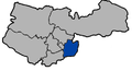
 Tc n.png 471 × 255; 32 KB
-
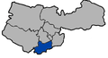
 Tc nt.png 471 × 255; 32 KB
-
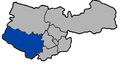
 Tc s.png 471 × 255; 32 KB
-
 Tc st.png 471 × 255; 31 KB
-
 Tc w.png 471 × 255; 32 KB
-
 Tc-CenterDi.png 471 × 255; 32 KB


