Category:Maps of Taichung City
Jump to navigation
Jump to search
English: This category is only suitable for during the provincial city(1947-2010).
日本語: このカテゴリは省轄市(1974-2010)にのみ適用されます。
中文(臺灣):這個類別只適用於省轄市期間(1974-2010)。
Subcategories
This category has only the following subcategory.
Media in category "Maps of Taichung City"
The following 15 files are in this category, out of 15 total.
-
 Districts of Taichung-Taiwan.png 352 × 186; 11 KB
-
 Districts of Taichung-Taiwan.svg 754 × 428; 26 KB
-
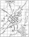 Downtoun Map of Taichung City 1967.jpg 1,252 × 1,600; 341 KB
-
 Map of Taichu City 1916.jpg 3,559 × 3,146; 4.32 MB
-
 Map of Taichu City.jpg 2,720 × 4,126; 2.64 MB
-
 Map of Taichung City (ko).png 372 × 226; 29 KB
-
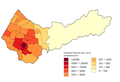 Population density map of Taichung (Dec 2019).png 1,468 × 1,008; 58 KB
-
 Reminder of heavy rain by Taichung City Government 2023-06-09.jpg 1,890 × 1,890; 528 KB
-
 Taichung City Location Map.png 417 × 549; 34 KB
-
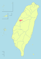
 Taichung City location.png 211 × 296; 7 KB
-
 Taichung City Location.svg 850 × 1,200; 141 KB
-
 Taichung Districts.PNG 1,100 × 600; 95 KB
-
 Taichung Districts.png 1,100 × 600; 71 KB
-
 Taiwan ROC political division map Taichung City.svg 850 × 1,200; 163 KB
-
 Txu-pclmaps-oclc-6550512-taichu-2219-iii.jpg 4,596 × 4,183; 7.02 MB


.png)
.png)


