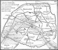
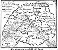
Category:Maps of floods in Paris
Appearance
Media in category "Maps of floods in Paris"
The following 7 files are in this category, out of 7 total.
-
Map of 1740 Flood of Paris.jpg 1,104 × 850; 447 KB
-
Plan de l'inondation de janvier 1910 - BHVP.jpg 4,793 × 3,762; 4.62 MB
-
Plan du cours de la Seine dans la traversée de Paris... - BHVP.jpg 1,824 × 1,444; 860 KB
-
Seinehochwasser 1910, Karte.png 953 × 818; 408 KB
-
Seinehochwasser von 1910, Karte des Überschwemmungsgebiet in Paris.jpg 807 × 701; 338 KB


