Category:Maps of faults
Jump to navigation
Jump to search
Subcategories
This category has the following 5 subcategories, out of 5 total.
F
- Fault maps of New Zealand (9 F)
- Faults in South Korea (10 F)
J
- Maps of faults in Japan (23 F)
M
T
- Maps of faults in Taiwan (7 F)
Media in category "Maps of faults"
The following 59 files are in this category, out of 59 total.
-

-

-

-
 2018 Sulawesi Earthquakes faults.jpg 600 × 500; 101 KB
-
 551 of 'Text-Book of Geology' (11280417676).jpg 1,296 × 1,071; 253 KB
-
 Arrábida Fault trace.jpg 1,586 × 1,143; 197 KB
-
 Bouvettriplenarrow3d.svg 1,020 × 609; 505 KB
-
 Carte des failles actives en France métropolitaine.jpg 1,535 × 1,395; 1.47 MB
-
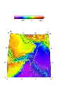
 Charlie-gibbs-full-extent.png 1,020 × 626; 310 KB
-
 Charliegibbstransform.png 1,020 × 609; 303 KB
-
 Chile ridge Fault Zone segments.png 1,270 × 741; 1.72 MB
-
 Chile ridge fz segments.png 1,004 × 741; 1.34 MB
-
 DeadSeaTransform.png 741 × 1,646; 1.41 MB
-
 Die Hauptverwerfungslinien im inneren Kristianiafjord.jpg 1,833 × 2,991; 1.67 MB
-
 Diendorfer Störung.png 574 × 800; 932 KB
-
 Emplacement des failles, des sondages et des principaux puits.jpg 1,987 × 1,539; 754 KB
-
 Eumseong pull-apart basin.jpg 1,175 × 925; 445 KB
-
 Faille de Cadillac.png 963 × 464; 393 KB
-
 Faults in qiantang basin.svg 1,730 × 1,295; 156 KB
-
 Faults updated.png 1,316 × 1,125; 2.59 MB
-
 FaultsIran.png 836 × 785; 272 KB
-
 GaeumFS.jpg 1,444 × 1,760; 1.09 MB
-
 Geo Oslofeltet map no 01.JPG 700 × 1,200; 266 KB
-
 GPS copy.gif 970 × 569; 97 KB
-
 Great Glen Fault map.png 2,455 × 2,590; 1.18 MB
-
 Great glen fault.png 144 × 250; 7 KB
-
 Great Sumatran Fault.png 2,446 × 2,481; 3.28 MB
-
 Guide to common map symbols.svg 300 × 450; 18 KB
-
 Haiti fault satellite image.jpg 6,662 × 5,139; 6.04 MB
-
 Hercynian structures Europe-en.svg 850 × 555; 131 KB
-
 Hercynian structures Europe-es.svg 2,239 × 1,455; 516 KB
-
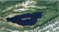 Issyk Kul.png 1,348 × 745; 1.36 MB
-
 JPVD-NGTM2023-Network.jpg 1,310 × 756; 403 KB
-
 JPVD-NGTM2023-Terranes.jpg 6,000 × 2,747; 2.06 MB
-
 Karakorum fault superimposed on top of topographic map.pdf 1,275 × 1,650; 431 KB
-
 Lebanon tectonics-ar.png 1,816 × 2,111; 1.05 MB
-
 Lebanon tectonics.png 1,816 × 2,111; 787 KB
-
 Map-Aire Gap England.png 586 × 457; 305 KB
-
 Map-Aire Gap North-England.png 705 × 548; 108 KB
-
 Motoki FalhaTransformanteSaoPaulo.jpg 942 × 608; 83 KB
-
 Owen.svg 2,480 × 3,509; 2.66 MB
-
 PhilippineFaultSystem019.gif 695 × 877; 155 KB
-
 Puget Sound faults.png 384 × 640; 612 KB
-

-
-
 Scotiazee en scotiarug.png 1,280 × 747; 624 KB
-
 Simplified geological map of Sicily.svg 853 × 521; 474 KB
-
 Sumatra Volcanoes.png 600 × 527; 141 KB
-
 Tectonic setting western Mexico.png 1,929 × 1,570; 1.8 MB
-
 The New Glocal Tectonic Map - Hemisphere Projections.jpg 1,753 × 919; 531 KB
-
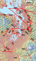
 TianShan Tectonic Map.jpg 2,676 × 868; 185 KB
-
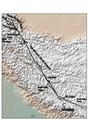
 TibetanPlateauTectonics.png 3,422 × 2,055; 12.1 MB
-
 Ungefährer Verlauf der Diendorfer Störung.png 815 × 753; 88 KB
-
 Vemafracturezone-qgis.svg 1,052 × 744; 2.34 MB
-
 Vematransform.png 1,020 × 609; 282 KB
-
 West Valley Fault Line Carmona Estates.jpg 1,920 × 1,080; 303 KB
-
 Xiong'er Simplified Geologic Map.jpg 720 × 450; 74 KB
-
 Zona de Fractura Shackleton.png 397 × 582; 238 KB
-
 Дахт-и-Навар.jpg 3,261 × 3,911; 2.96 MB
.jpg)
.jpg)
.jpg)

.jpg)


.jpg)


