Category:Maps of ethnic groups in Pakistan
Jump to navigation
Jump to search
Media in category "Maps of ethnic groups in Pakistan"
The following 23 files are in this category, out of 23 total.
-
Autonomous regions in the Middle East and Asia.jpg 720 × 694; 204 KB
-
Demography of Awan tribe in Pakistan.png 617 × 607; 97 KB
-
Distribution of Gurjars within South Asia.jpg 425 × 321; 44 KB
-
Ethnic Pashtun regions in Afghanistan-Pakistan.gif 966 × 1,233; 370 KB
-
Ethnien in Pakistan 1980.svg 920 × 891; 263 KB
-
Ethnien in Pakistan hu.svg 920 × 891; 310 KB
-
Hazara Division Ethnic Map.gif 283 × 597; 30 KB
-
Largest Hindu Caste by District (Census 1931).jpg 781 × 592; 125 KB
-
Major ethnic groups of Pakistan in 1980 borders removed.jpg 960 × 928; 182 KB
-
Major ethnic groups of Pakistan in 1980-es.svg 920 × 891; 275 KB
-
Major ethnic groups of Pakistan in 1980.jpg 960 × 928; 153 KB
-
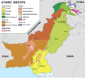
Major ethnic groups of Pakistan in 1980.svg 920 × 891; 275 KB
-
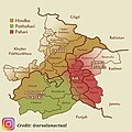
Pahari-Potohari-Hindko Map.jpg 1,080 × 1,076; 163 KB
-
Pakistan ethnic 1973.jpg 769 × 730; 129 KB
-
Pakistan ethnic map 1973-de.svg 796 × 636; 608 KB
-
Pakistan ethnic map 1973-es.svg 691 × 633; 514 KB
-
Pakistan ethnic map 1973-mk.svg 2,065 × 1,890; 758 KB
-
Pakistan ethnic map 1973-ru.svg 2,050 × 1,890; 724 KB
-
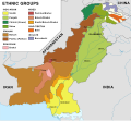
Pakistan ethnic map 1973-v2.svg 2,050 × 1,890; 932 KB
-
Pakistan ethnic map.svg 2,050 × 1,890; 1,012 KB
-
Pakistan Volksgruppen.jpg 769 × 730; 84 KB
-
Saraikistan.JPG 532 × 455; 41 KB


