Category:Maps of ethnic groups in India
Jump to navigation
Jump to search
Media in category "Maps of ethnic groups in India"
The following 38 files are in this category, out of 38 total.
-
(1882) MAP OF THE TRIBES OF INDIA.jpg 2,634 × 2,158; 1.57 MB
-
Andamanais-negritos-carte.png 737 × 567; 34 KB
-
Andamanese comparative distribution.png 737 × 567; 76 KB
-
Andamanese Indigenous people.svg 927 × 1,118; 392 KB
-
Area of Bais Rajput.jpg 331 × 323; 8 KB
-
Baiga distribution.svg 1,500 × 1,615; 3.14 MB
-
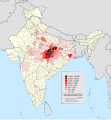
Brahmin population distribution.svg 1,500 × 1,615; 1.37 MB
-
Distribution of Gurjars within South Asia.jpg 425 × 321; 44 KB
-
Ethnien in Pakistan 1980.svg 920 × 891; 263 KB
-
Ethnien in Pakistan hu.svg 920 × 891; 310 KB
-
Geopolitical map of Bagals.png 1,992 × 2,470; 2.33 MB
-
Gondi tribe percent by districts 2011 census.png 1,500 × 1,615; 714 KB
-
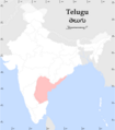
Idioma telugu.png 316 × 368; 6 KB
-
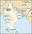
Indian Jews communities map-de.png 328 × 352; 44 KB
-
Indian Jews communities map-fr.png 328 × 352; 45 KB
-
Indian Jews communities map.png 328 × 352; 44 KB
-
KayasthaPopMap.JPG 578 × 674; 57 KB
-
KayasthaPopMigration.JPG 591 × 675; 51 KB
-
Mahl origin locator.PNG 513 × 724; 64 KB
-
Mahl relation locator.png 513 × 724; 64 KB
-
Major ethnic groups of Pakistan in 1980 borders removed.jpg 960 × 928; 182 KB
-
Major ethnic groups of Pakistan in 1980-es.svg 920 × 891; 275 KB
-
Major ethnic groups of Pakistan in 1980.jpg 960 × 928; 153 KB
-
Major ethnic groups of Pakistan in 1980.svg 920 × 891; 275 KB
-
MangaloreanCatholicDistribution.JPG 518 × 479; 19 KB
-
Map India jews communities fr.jpg 330 × 355; 74 KB
-
Map India jews communities.jpg 330 × 355; 28 KB
-
Marwari map.PNG 661 × 600; 96 KB
-
Padhar in gujarat.jpg 1,021 × 783; 83 KB
-
Peoples of South Asia Sindhi Sumra.png 970 × 733; 404 KB
-
Percent of scheduled tribes in India by tehsils by census 2011.png 4,280 × 4,688; 2.38 MB
-
Percent of scheduled tribes in India-tehsils-census 2011.svg 2,268 × 2,201; 7.1 MB
-
Rajput mahrajas.JPG 435 × 356; 9 KB
-
Spread of Telugu.png 234 × 244; 11 KB
-
St distribution of Odisha.jpg 538 × 415; 50 KB
-
Telugu USC2000 PHS.svg 959 × 593; 174 KB
-
Teluguspeakers.png 1,000 × 1,138; 132 KB
-
Volker-Karte der Indischen Welt 1847.jpg 2,954 × 2,420; 2.22 MB


