Category:Maps of cities in Andalusia
Jump to navigation
Jump to search
Autonomous communities of Spain: Andalusia · Asturias · Basque Autonomous Community · Catalonia · Extremadura · Galicia · Navarre · Valencian Community · Autonomous cities:
Subcategories
This category has the following 61 subcategories, out of 61 total.
A
- Maps of Ayamonte (5 F)
B
- Maps of Baena (4 F)
- Maps of Baeza (6 F)
- Maps of Baza (5 F)
- Maps of Benalúa (3 F)
- Maps of Benamaurel (5 F)
C
- Maps of Cabra (Córdoba) (7 F)
- Maps of Camas (5 F)
- Maps of Carmona (7 F)
D
- Maps of Dos Hermanas (5 F)
E
- Maps of Estepona (9 F)
F
- Maps of Fuengirola (10 F)
G
- Maps of Gibraleón (5 F)
- Maps of Guadix (7 F)
H
- Maps of Huelva (14 F)
J
- Maps of Jaén (16 F)
L
- Maps of La Zubia (3 F)
- Maps of Linares (7 F)
- Maps of Los Barrios (8 F)
- Maps of Lucena (Córdoba) (7 F)
M
- Maps of La Algaba (8 F)
- Maps of Marbella (20 F)
- Maps of Marinaleda (3 F)
- Maps of Mijas (18 F)
- Maps of Moguer (21 F)
- Maps of Montilla (4 F)
- Maps of Montoro (4 F)
- Maps of Motril (6 F)
N
- Maps of Nerja (5 F)
- Maps of Niebla, Spain (7 F)
- Maps of Níjar (5 F)
O
P
- Maps of Puente Genil (6 F)
R
- Maps of Ronda (6 F)
S
T
- Maps of Torremolinos (10 F)
U
- Maps of Utrera (5 F)
V
Media in category "Maps of cities in Andalusia"
The following 3 files are in this category, out of 3 total.
-
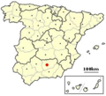
Jaen, Spain location.png 256 × 233; 77 KB
-
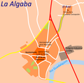
La Algaba.png 658 × 650; 74 KB
-
Locator map for Purchena.png 1,024 × 879; 114 KB


