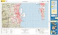
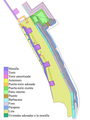
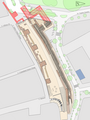
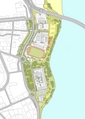
Category:Maps of Algeciras
Jump to navigation
Jump to search
Municipalities of the province of Cádiz: Algeciras · Arcos de la Frontera · Bornos · Cádiz · Castellar de la Frontera · Chipiona · Conil de la Frontera · El Puerto de Santa María · Jerez de la Frontera · Jimena de la Frontera · La Línea de la Concepción · Los Barrios · Medina Sidonia · Rota · San Roque · Tarifa ·
Wikimedia category | |||||
| Upload media | |||||
| Instance of | |||||
|---|---|---|---|---|---|
| Category combines topics | |||||
| Algeciras | |||||
municipality and city in the Province of Cádiz, Spain   .svg) .svg) | |||||
| Instance of | |||||
| Part of | |||||
| Location | Cádiz Province, Andalusia, Spain | ||||
| Located in or next to body of water | |||||
| Head of government | |||||
| Significant event |
| ||||
| Population |
| ||||
| Area |
| ||||
| Elevation above sea level |
| ||||
| Replaces | |||||
| Different from | |||||
| official website | |||||
 | |||||

Subcategories
This category has the following 3 subcategories, out of 3 total.
Media in category "Maps of Algeciras"
The following 107 files are in this category, out of 107 total.
-
 1700s Algeciras.jpg 400 × 289; 53 KB
-
 1734 - Juan de Subreville - Isla de Algeciras.jpg 640 × 498; 118 KB
-
 Acacias limpio.png 2,219 × 3,446; 1.24 MB
-
 Acacias.png 2,219 × 3,446; 1.31 MB
-
 Admiralty Chart No 1448 Gibraltar Bay, Published 1968.jpg 11,336 × 16,443; 41.53 MB
-
 Al Yazirat recreación 01.png 2,000 × 1,373; 4.11 MB
-
 Al Yazirat recreación 02.png 2,000 × 1,571; 4.16 MB
-
 Algeciras 1801 english.png 1,000 × 1,154; 1.35 MB
-
 Algeciras 1801 español batalla.jpg 741 × 772; 132 KB
-
 Algeciras 1801 español.png 1,000 × 1,154; 1.35 MB
-
 Algeciras Arabe grande6.jpg 1,400 × 731; 168 KB
-
 Algeciras centro.jpg 1,000 × 791; 318 KB
-
 Algeciras costa.jpg 1,765 × 2,167; 411 KB
-
 Algeciras distritos electorales 2018 colegios electorales.png 3,500 × 3,765; 2.59 MB
-
 Algeciras distritos electorales 2018.png 3,500 × 3,765; 2.58 MB
-
 Algeciras fuertes grande.jpg 1,462 × 836; 178 KB
-
 Algeciras físico.jpg 1,680 × 2,082; 392 KB
-
 Algeciras geologico.jpg 1,680 × 2,082; 726 KB
-
 Algeciras hidrologia.jpg 1,680 × 2,082; 704 KB
-
 Algeciras mapa de unidades de paisaje.png 7,000 × 7,529; 14.05 MB
-
 Algeciras mapa de unidades de vegetación.png 7,000 × 7,529; 14.55 MB
-
 Algeciras mapa geológico.png 7,000 × 7,529; 14.15 MB
-
 Algeciras mapa hidrológico.png 7,000 × 7,529; 13.57 MB
-
 Algeciras mapa marino.png 3,000 × 3,500; 3.7 MB
-
 Algeciras mapa topográfico.png 7,000 × 7,529; 13.3 MB
-
 Algeciras mapa término municipal limpio.png 7,000 × 7,529; 12.84 MB
-
 Algeciras medieval con leyenda.png 5,000 × 3,584; 3.93 MB
-
 Algeciras medieval limpio.png 5,000 × 3,584; 3.68 MB
-
 Algeciras medieval sin leyenda.png 5,000 × 3,584; 3.71 MB
-
 Algeciras paisaje.jpg 1,680 × 2,082; 405 KB
-
 Algeciras Parque Feria leyenda 01.png 1,500 × 1,804; 1.46 MB
-
 Algeciras Parque Feria limpio.png 1,500 × 1,804; 1.38 MB
-
 Algeciras PGOU.jpg 1,680 × 2,082; 244 KB
-
 Algeciras plano Iglesia de La Palm limpio.png 1,800 × 1,799; 576 KB
-
 Algeciras plano Iglesia de La Palma con leyenda.png 1,800 × 1,799; 745 KB
-
 Algeciras plano Iglesia de La Palma.png 1,800 × 1,799; 646 KB
-
 Algeciras Plaza Alta entorno BIC leyenda 01.png 1,331 × 1,596; 2.06 MB
-
 Algeciras Plaza Alta entorno BIC.png 1,331 × 1,596; 1.98 MB
-
 Algeciras romano con leyenda.png 3,885 × 2,448; 2.04 MB
-
 Algeciras romano limpio.png 3,885 × 2,448; 1.88 MB
-
 Algeciras romano sin leyenda.png 3,885 × 2,448; 1.9 MB
-
 Algeciras ruta Paco de Lucía.png 2,000 × 2,791; 5.18 MB
-
 Algeciras Sitio de Alfonso XI.jpg 1,750 × 979; 334 KB
-
 Algeciras vegetacion.jpg 1,680 × 2,082; 439 KB
-
 Algeciras Villa Vieja Campamento-ar.jpg 1,000 × 938; 259 KB
-
 Algeciras Villa Vieja Campamento.jpg 1,000 × 938; 307 KB
-
 AlgecirasArabe.jpg 2,560 × 1,706; 1.19 MB
-
 AlgecirasArabe2.jpg 1,000 × 938; 326 KB
-
 Areas homogeneas Algeciras.png 2,500 × 1,791; 2.53 MB
-
 Arqueologico medieval.jpg 1,800 × 1,218; 1.29 MB
-
 Arqueologico romano.jpg 1,800 × 1,218; 1.17 MB
-
 Avenida Blas Infante.jpg 1,000 × 791; 968 KB
-
 Bahia de Algeciras fuertes costeros.png 1,500 × 1,895; 621 KB
-
 Bahia de Algeciras torres de vigilancia.png 1,500 × 1,895; 727 KB
-
 Bahía de Algeciras búnkers.png 1,500 × 1,895; 734 KB
-
 Bahía de Algeciras mapa limpio.jpg 1,540 × 1,935; 1.52 MB
-
 Bahía de Algeciras siglo IX.jpg 1,540 × 1,935; 1.74 MB
-
 Barrios de Algeciras.png 633 × 1,110; 135 KB
-
 Bunkers en los alrededores de la bahía de Algeciras.jpg 500 × 712; 83 KB
-
 Calle Alfonso XI.jpg 1,000 × 791; 961 KB
-
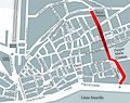
 Calle Regino Martínez mapa.jpg 1,000 × 791; 960 KB
-
 Campo de Gibraltar carreteras Algeciras.png 1,274 × 1,164; 560 KB
-
 Cora de algeciras.jpg 1,200 × 957; 203 KB
-
 Cristina plano.png 1,800 × 2,302; 1.75 MB
-
 CTMCG-zonas-bahía.png 1,180 × 890; 99 KB
-
 CTMCG-zonas.png 1,000 × 750; 102 KB
-
 Escuela de Artes algeciras.png 1,253 × 1,461; 502 KB
-
 Estrecho arabe.jpg 1,000 × 926; 221 KB
-
 Estrecho mapa costa.png 1,257 × 647; 260 KB
-
 Estrecho mapa fisico.png 1,239 × 674; 961 KB
-
 Estrecho mapa general.png 1,000 × 633; 131 KB
-
 Estrecho mapa urbano.png 1,214 × 647; 668 KB
-
 Estrecho mapa zonas.png 1,214 × 647; 229 KB
-
 Estrecho mapa.JPG 1,214 × 647; 168 KB
-
 Fuertes.jpg 900 × 830; 131 KB
-
 Huerta del carmen mapa 2016.png 2,000 × 1,629; 1.61 MB
-
 Huerta del carmen mapa 2020.png 1,200 × 1,713; 1.26 MB
-
 Karte Gemeinde Algeciras 2022.png 2,500 × 2,834; 812 KB
-
 Mercado Ingeniero Torroja plano.png 2,065 × 1,500; 492 KB
-
 MTN25-1078c1-1998-Algeciras.jpg 7,623 × 5,094; 5.73 MB
-
 MTN25-1078c1-2007-Algeciras.jpg 7,874 × 5,148; 10.65 MB
-
 MTN25-1078c1-2015-Algeciras.jpg 8,661 × 5,194; 25.52 MB
-
 MTN25-1078c2-2015-Algeciras.jpg 8,661 × 5,194; 25.52 MB
-
 Paraje Marismas del Palmones.jpg 924 × 747; 136 KB
-
 Paraje natural de las marismas del Río Palmones plano.png 1,000 × 808; 448 KB
-
 Parque arqueologico Murallas de Algeciras esquema.png 1,000 × 1,333; 459 KB
-
 Parque arqueologico plano.png 1,200 × 1,600; 904 KB
-
 Parque conferencia plano sin leyenda.png 1,500 × 2,083; 1.11 MB
-
 Parque de la Conferencia plano.png 1,500 × 2,083; 1.23 MB
-
 Parque del Centenario limpio.png 2,316 × 2,039; 909 KB
-
 Parque del centenario.png 2,316 × 2,039; 967 KB
-
 Parque María Cristina Algeciras mapa limpio.png 1,800 × 2,302; 1.77 MB
-
 Paseo Cornisa limpio.png 1,423 × 2,000; 1,018 KB
-
 Paseo Cornisa.png 1,423 × 2,000; 1.1 MB
-
 Plano Algeciras 1723.png 3,000 × 2,150; 2.09 MB
-
 Plano Algeciras fortaleza.png 3,344 × 2,015; 2.53 MB
-
 Plano de algeciras carril bici.png 3,500 × 4,883; 8.35 MB
-
 Plano de algeciras patrimonio inmueble.png 3,700 × 5,162; 8.77 MB
-
 Plano de algeciras turístico.png 3,500 × 4,883; 8.53 MB
-
 Plano de Algeciras.png 3,500 × 4,883; 7.89 MB
-
 Semana Santa de Algeciras carrera oficial.png 1,500 × 945; 1 MB
-
 Trazado del acueducto de algeciras.png 3,000 × 2,116; 4.8 MB
-
 Villa Nueva.png 2,500 × 1,792; 2.97 MB
-
 Villa Vieja.png 2,500 × 1,792; 2.98 MB
-
 Yacimientos Calle San Nicolás Algeciras grande.png 1,795 × 2,029; 764 KB
-
 Yacimientos Calle San Nicolás Algeciras.png 1,638 × 1,116; 562 KB
-
 Yacimientos romanos de Algeciras.png 1,500 × 1,895; 818 KB


