Category:Maps of census statistical areas in California
Jump to navigation
Jump to search
States of the United States: Alabama · Alaska · Arizona · Arkansas · California · Colorado · Connecticut · Delaware · Florida · Georgia · Idaho · Illinois · Indiana · Iowa · Kansas · Kentucky · Louisiana · Maine · Maryland · Massachusetts · Michigan · Minnesota · Mississippi · Missouri · Montana · Nebraska · Nevada · New Hampshire · New Jersey · New Mexico · New York · North Carolina · North Dakota · Ohio · Oklahoma · Oregon · Pennsylvania · Rhode Island · South Carolina · South Dakota · Tennessee · Texas · Utah · Vermont · Virginia · Washington · West Virginia · Wisconsin
Puerto Rico
Puerto Rico
Media in category "Maps of census statistical areas in California"
The following 9 files are in this category, out of 9 total.
-
 California CBSAs.png 4,740 × 4,266; 1.21 MB
-
 Fresno-Madera CSA.png 421 × 489; 24 KB
-
 Map of the USA highlighting the Greater Los Angeles Area.gif 4,200 × 3,105; 1.53 MB
-
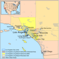 GreaterLAmap.png 1,000 × 1,000; 621 KB
-
 U.S. - Los Angeles Metropolitan Area location map.svg 512 × 539; 176 KB
-
 Los Angeles County Mexican 2000.png 1,352 × 916; 621 KB
-
 Sacramento-Arden-Arcade-Roseville Metropolitan Area.png 421 × 489; 24 KB
-
 San Jose-San Francisco-Oakland CSA.png 421 × 489; 24 KB
-
 San Jose-San Francisco-Oakland CSA.svg 621 × 733; 255 KB


